Long before it was a road, it was a river. The Mississippi doesn’t flow to the Gulf of Mexico so much as it meanders — oxbowing, flooding, depositing sediment on its banks and pulling it back again over millennia. The result is the natural levee: a ribbon of high ground along each bank, elevated just enough above the surrounding swamp to be habitable. The French recognized it immediately. By the 1720s, settlers were stringing their narrow land grants along both banks — each grant stretching back from the river…
Read the full story
Landmarks
14 places worth the detour
Includes 4 ghost landmarks— places that existed here and don’t anymore
tap the eye to open · swipe or use buttons to browse
Lost places
Reading
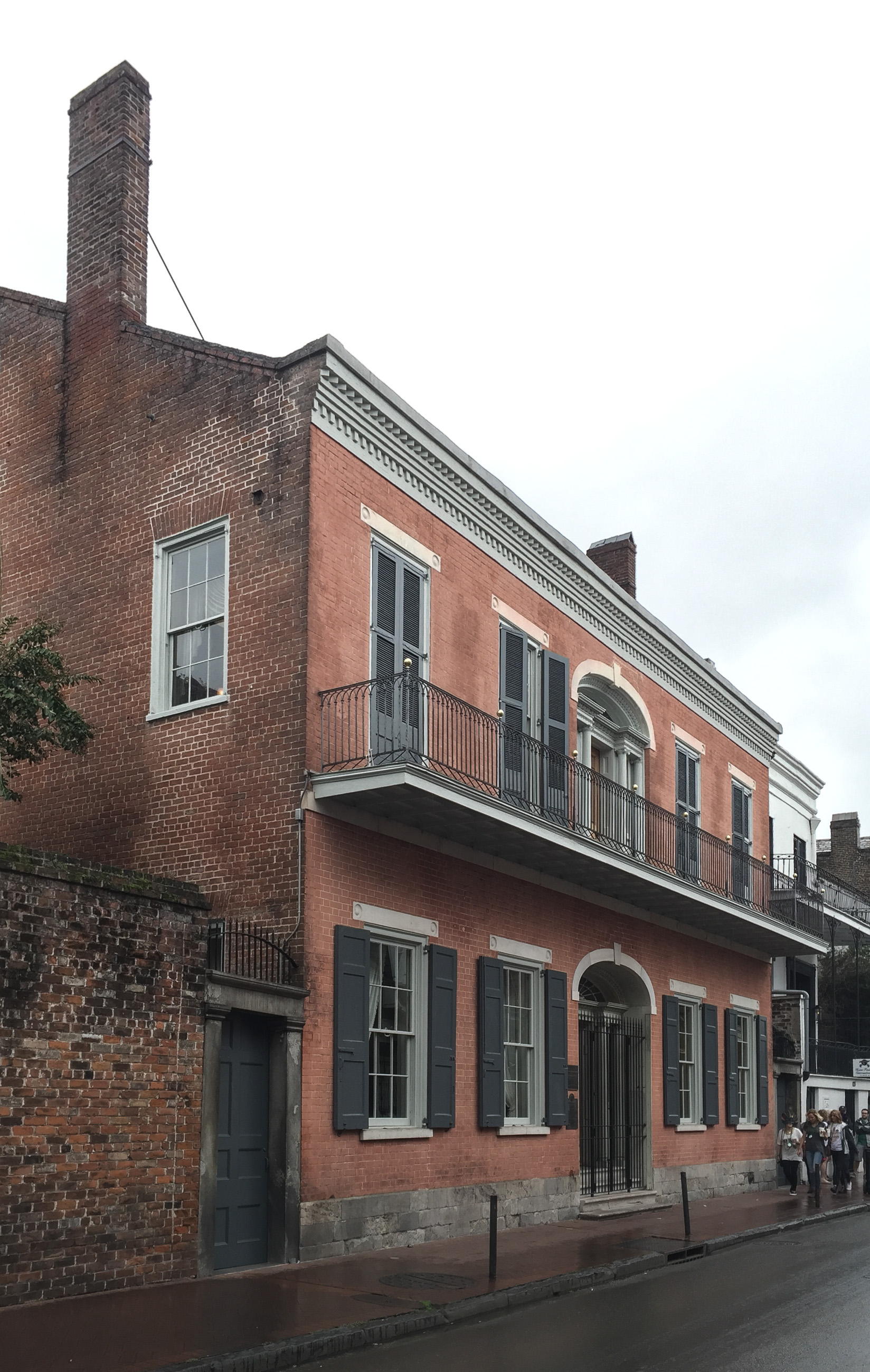
Upriver from New Orleans, the lower Mississippi runs through a stretch of land called the German Coast — named for German immigrants who settled and farmed it. Samuel Hermann, born in Rödelheim, arrived in 1804 and settled the German Coast before moving down to New Orleans. He worked as an agent and broker for plantation owners and merchants, expanded into mortgages, stocks, and real estate, and by 1831 had become one of the wealthiest men in the antebellum city. That year he hired architect William Brand to build a residence on St. Louis Street — the only American Federal-style house in the French Quarter, with balconies and galleries grafted onto the symmetrical Federal form to suit the climate. The German wave never had the cultural visibility of the French or the Spanish, but the place name persisted: the German Coast is still the German Coast.
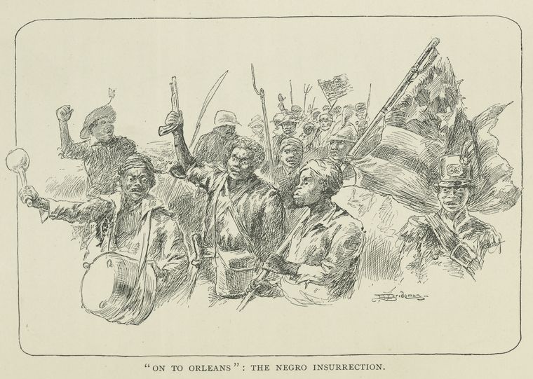
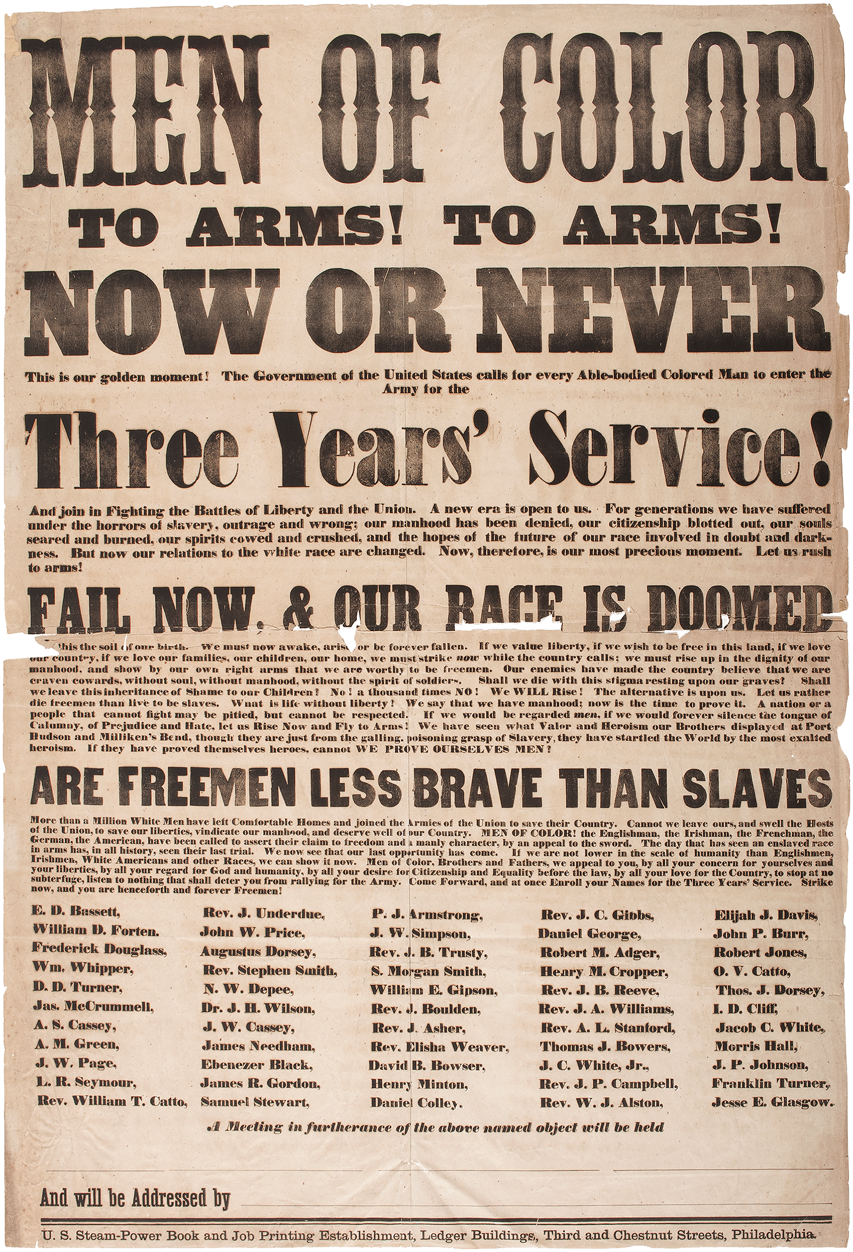
The River Road between New Orleans and Baton Rouge is plantation country in the popular imagination — and that framing misses the people who actually shaped it. Beginning in the 1720s, German immigrants settled the west bank of the Mississippi in what became known as the Côte des Allemands, the German Coast. They had been recruited by John Law's Mississippi Company with promises of land and prosperity, crossed the Atlantic under brutal conditions, and arrived to find nothing prepared for them. A third died in the first years. The survivors planted. They became the food supply of early New Orleans — vegetables, dairy, livestock — while the city's French elite grew tobacco and indigo. The Germans intermarried with French Creoles so thoroughly within two generations that the German names vanished entirely. Zweig became Labranche. Heidel became Haydel. Trépagnier swallowed whatever German name it replaced. The Whitney and Laura plantations sit on land that was German farm country before it was plantation country. The 1811 German Coast Uprising — the largest slave revolt in American history — drew its name from this same corridor. The people who organized those 500 marching enslaved people were doing so in the shadow of those German-turned-Creole plantations. The German Coast is a story about how completely people can disappear into a place, and how completely a place can be transformed by people who left no visible trace.

At the edge of Lake Maurepas, where the Manchac swamp thickens into old-growth cypress and the road ends, there used to be a town called Frenier. A few hundred people lived there — trappers, fishermen, laborers working the cypress lumber camps. A woman named Julia Brown lived there too, a voodoo practitioner known locally as a traiteur who healed and cursed in equal measure. The story, as locals tell it: Julia Brown spent the last years of her life singing a song about how she would take the whole town with her when she died. On September 29, 1915, the day of her funeral, a Category 4 hurricane made landfall directly over Frenier. Nearly every resident died. The town was never rebuilt. The graves are still there, visible from the levee road. Whether Julia Brown was a healer, a prophet, a curse, or simply a poor woman who died badly and got attached to a coincidence — depends entirely on who is telling the story. The swamp itself doesn't offer an opinion. The cypress knees stand where the houses stood. The roots hold the mud. The water goes where it wants.
In a six-square-mile patch of land in St. James Parish — and nowhere else on earth — farmers grow Perique tobacco. The variety is pressed under weights in whiskey barrels for months, fermenting into something dark, peppery, and violently aromatic: a tobacco so concentrated it is never smoked straight, only blended in small amounts with milder leaves. The Choctaw and Chickasaw were growing it before Europeans arrived. Pierre Chenet, a Acadian farmer, learned the curing method from indigenous producers around 1824 and began the commercial tradition. The Louisiana soil here — a specific combination of alluvial clay and river silt — produces a chemical composition in the leaf that cannot be replicated anywhere else. Agronomists have tried in Virginia, in Africa, in the Caribbean. It grows but it does not taste the same. Perique is why the River Road's agricultural history is not just plantation cotton and sugar. It is also this: a single indigenous tobacco variety, tended by Acadian farmers, that never left the parish it started in and never will.

Tours
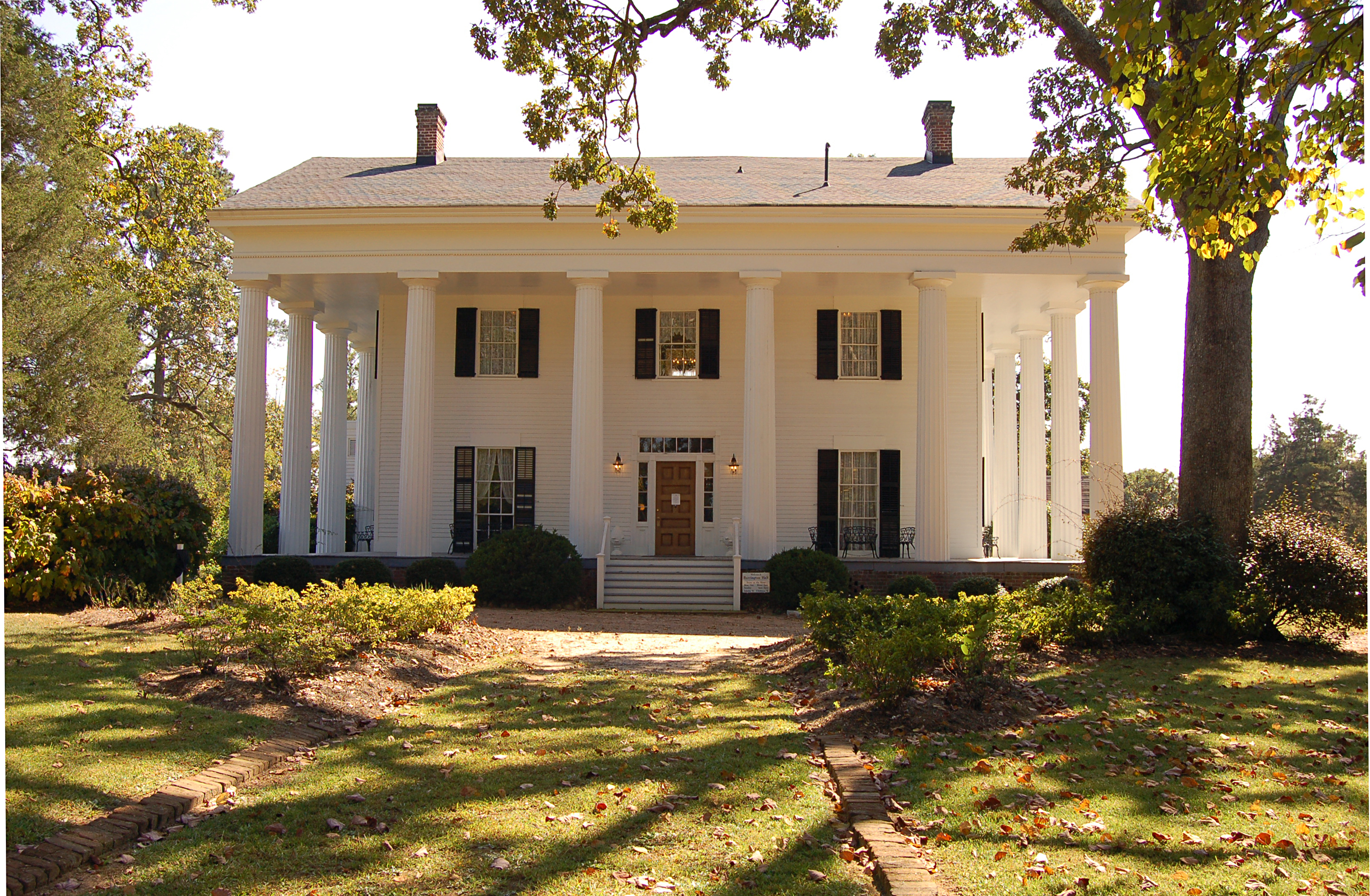
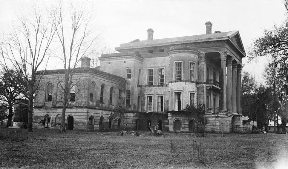
How one crop built the most concentrated collection of antebellum plantation architecture in America — and destroyed the lives of hundreds of thousands of people in the process. This drive moves upriver from the oldest plantation in the valley through the Creole and Anglo houses that sugar money raised, ending at the ruins of the largest antebellum mansion the South ever built.
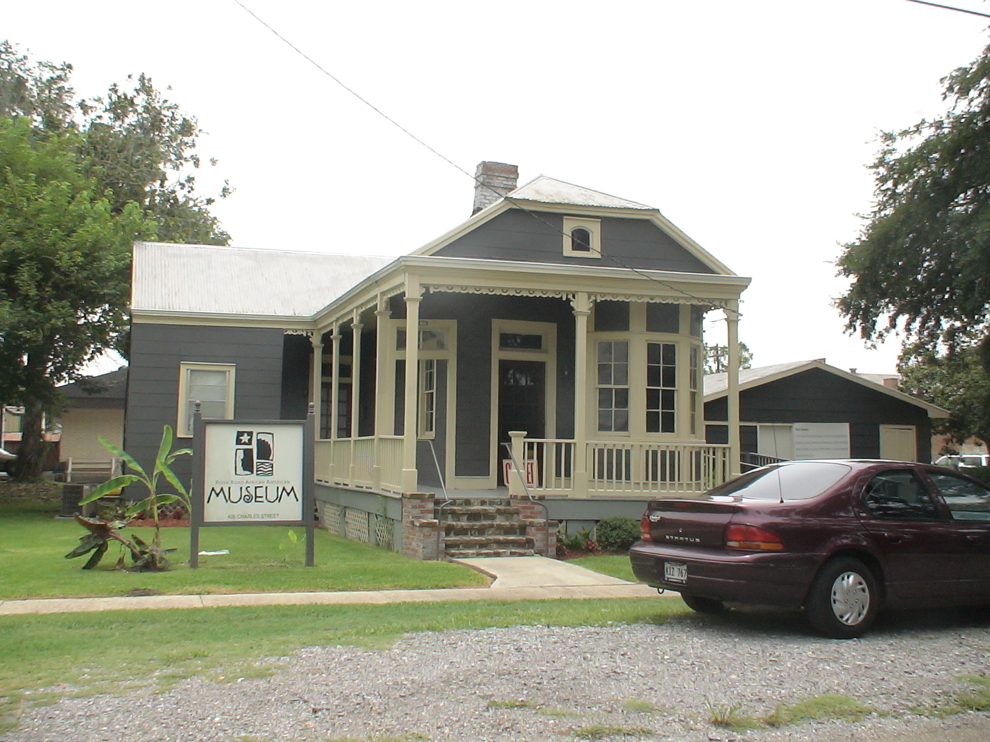
The largest slave revolt in American history started on this road. The only plantation museum that tells the enslaved story first is on this road. The most intact slave quarters in the country are on this road. And the first African American mayor in U.S. history was elected at the end of it. This is the River Road that the big-house tours don't lead with.
The Mississippi built everything on this corridor and threatens to take it back every spring. The Bonnet Carré Spillway opens every few years and floods 38,000 acres to save New Orleans. Houmas House sits inside an oil-refinery skyline now. Manresa Retreat House at Convent has gardens on a bluff that haven't moved in 190 years because the Jesuits built high while the planters built low. The river is what the trip is about; the levees are what the trip rides.
Plan your trip
Hotels, flights, and more for River Road.
Happening this month
Editorial content compiled with AI assistance. Place details verified against public records.