The valley belonged to the Tutelo and Monacan peoples first. For centuries before European contact, the Siouan-speaking nations of the Blue Ridge hunted the forests and fished the headwaters of the Roanoke River. The salt marshes and mineral licks along the valley floor drew game in such numbers that early European settlers called the area Big Lick. The name stuck for a hundred years. Scottish-Irish and German settlers pushed into the valley in the 1740s, following the Great Wagon Road south from Pennsylvania…
Read the full story
Landmarks
48 places worth the detour
Includes 2 ghost landmarks— places that existed here and don’t anymore
tap the eye to open · swipe or use buttons to browse
Lost places
Tours
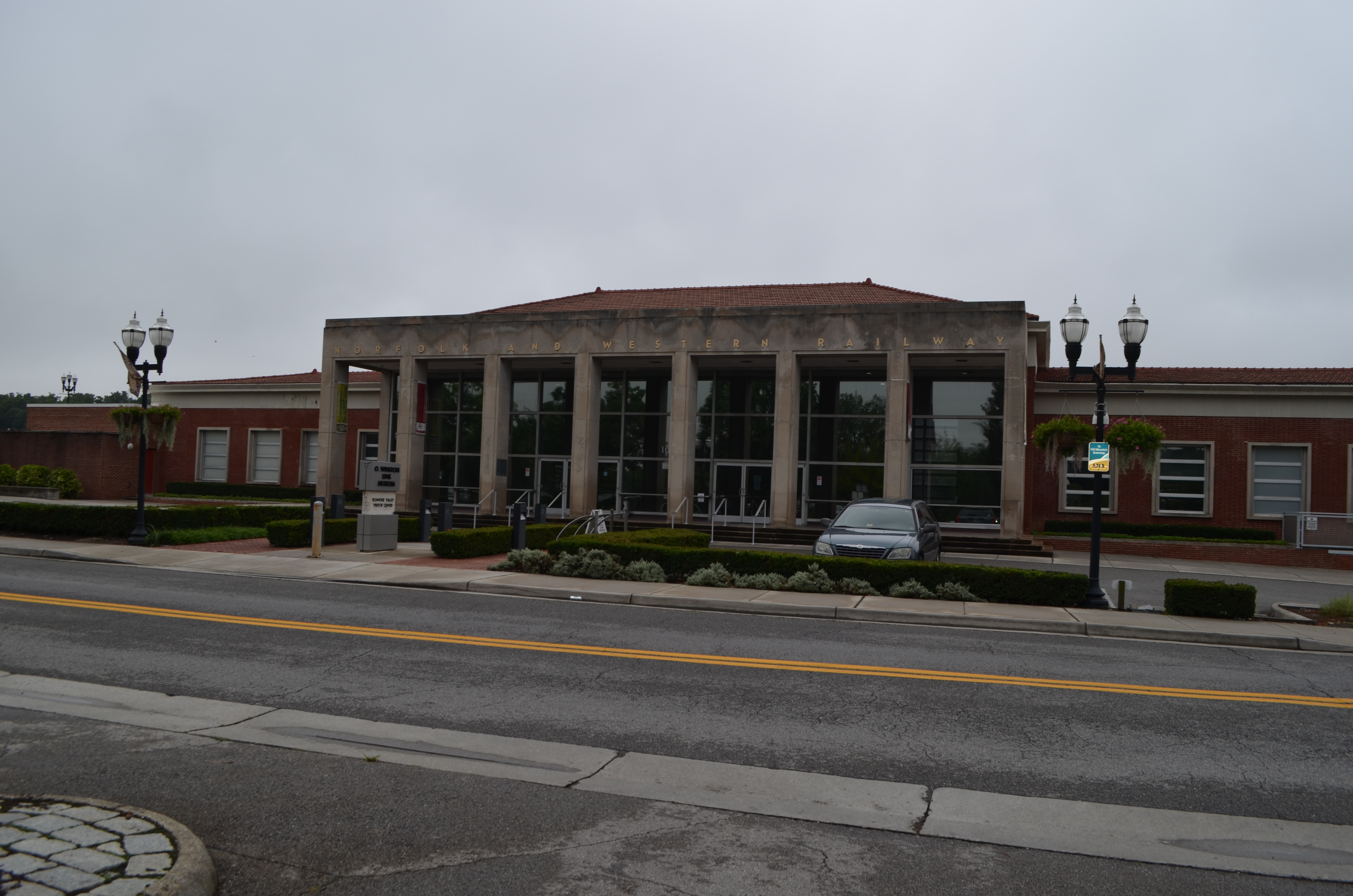
In 1882, a village of 500 people renamed itself and became a city of 25,000 inside a decade — because the Norfolk & Western Railway chose it as a junction. This walk connects the headquarters where the decision was made, the photographer who captured the last steam era in haunting black-and-white, the museum that holds the surviving locomotives, and the hotel the railroad built for its executives.
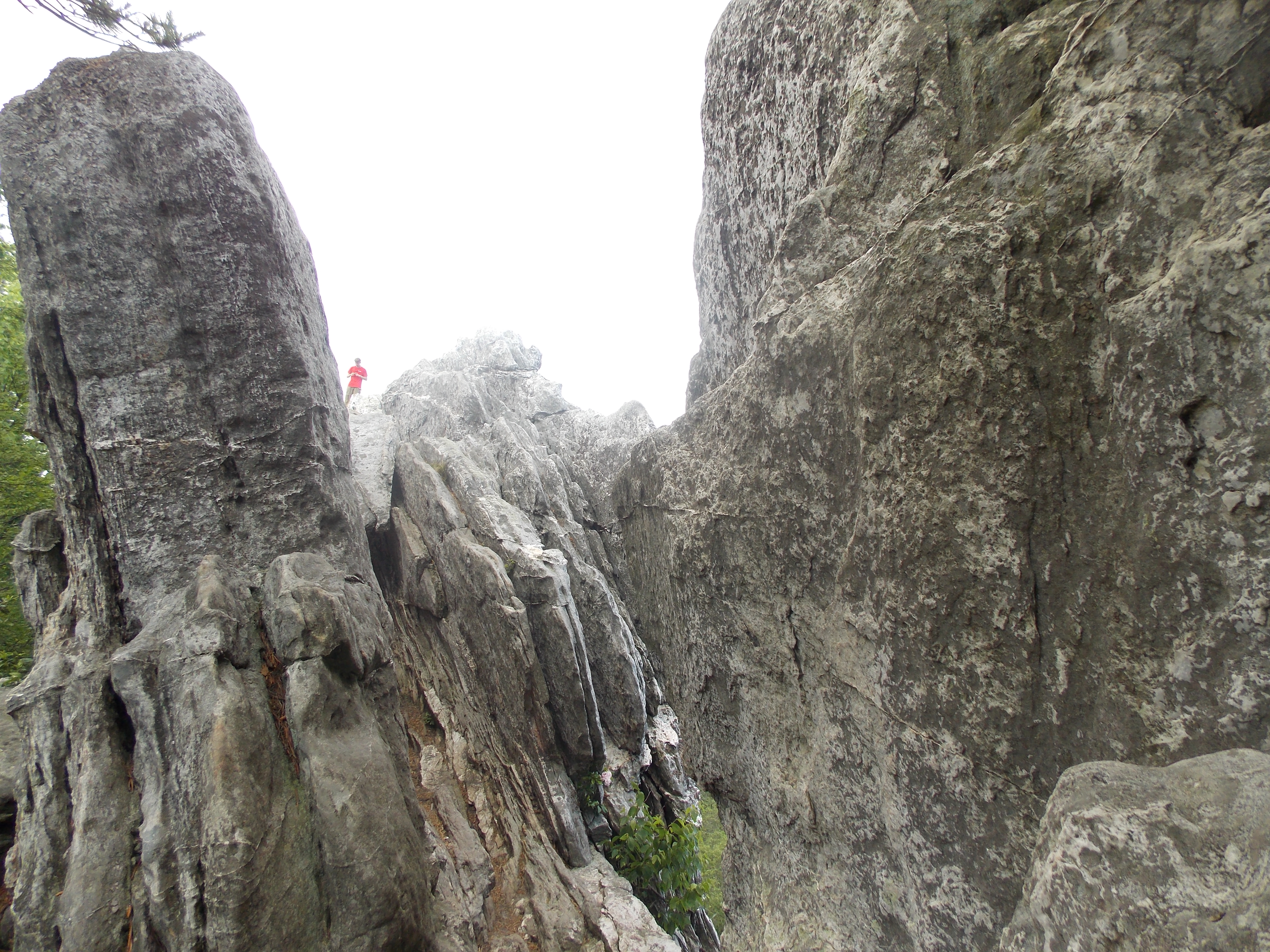
McAfee Knob is the most photographed spot on the entire Appalachian Trail, and all three trailheads of the Virginia Triple Crown sit within thirty minutes of downtown Roanoke. Dragon's Tooth is a 35-foot blade of Tuscarora sandstone reached by a scramble. Tinker Cliffs is a mile of exposed ridgeline at 3,000 feet with 270-degree views. McAfee is the flat sandstone shelf jutting over the Catawba Valley at 3,197 feet. No other city on the AT has this much ridge in its commute.
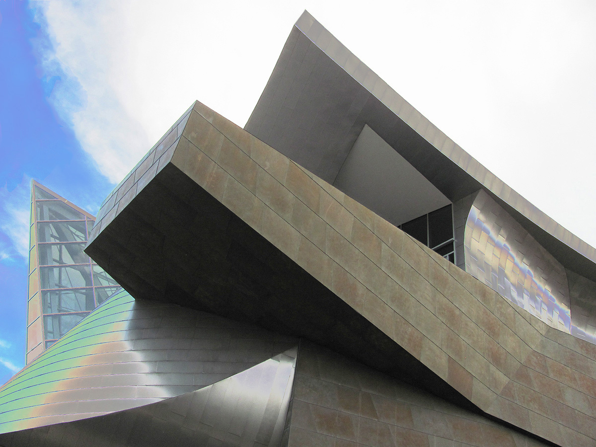
The Roanoke City Market has run continuously since 1882 — the oldest open-air market in Virginia and the spine of a downtown that does more with less than any small city in the South. opened in 2008, designed by Randall Stout, throws its zinc planes off the Norfolk Avenue corner. Center in the Square holds five museums on five floors of the old Heironimus department store. in the 1898 Norfolk & Western passenger station, holds the photographs of the railroad's last steam decade. Elmwood Park is where the city gathers.
Start at the Mill Mountain Star — 88 feet of neon erected in 1949, visible from 60 miles, the only municipal star this size in America. Climb the Parkway to Roanoke Mountain's overlook for the long valley view. Explore Park sits where the Blue Ridge meets the Roanoke River, with an early 1700s log cabin reassembled stick by stick. Carvins Cove closes the day: 12,463 acres of municipal park, 60 miles of trail, a 630-acre reservoir that doubles as the city's tap. The Parkway runs 469 miles. Roanoke is the southernmost city on it big enough to pull off.
The neighborhoods south and west of downtown are where Roanoke lives when it's not performing for visitors. Old Southwest has the largest intact collection of late Victorian architecture in Southwest Virginia. Black Dog Salvage made architectural salvage into a television show. The Grandin Theatre has been screening movies since 1932. Roanoke College in Salem has been educating students since 1842. This is the residential city the railroad built.
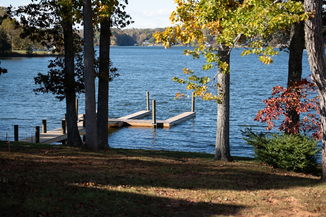
A small town of 3,200 sent its National Guard company to Normandy and lost 19 men in ten minutes — the highest per-capita D-Day loss of any community in America. The memorial built on the hilltop is devastating and specific. Then drive 20 minutes to Virginia's largest man-made lake and spend the afternoon on 500 miles of shoreline that most people outside the valley don't know exists.
Plan your trip
Hotels, flights, and more for Roanoke.
Happening this month
Editorial content compiled with AI assistance. Place details verified against public records.