The Triple Crown — Roanoke's Three Great Hikes
McAfee Knob is the most photographed spot on the entire Appalachian Trail, and all three trailheads of the Virginia Triple Crown sit within thirty minutes of downtown Roanoke. Dragon's Tooth is a 35-foot blade of Tuscarora sandstone reached by a scramble. Tinker Cliffs is a mile of exposed ridgeline at 3,000 feet with 270-degree views. McAfee is the flat sandstone shelf jutting over the Catawba Valley at 3,197 feet. No other city on the AT has this much ridge in its commute.
The route
 1Nature & Parks·1936McAfee Knob
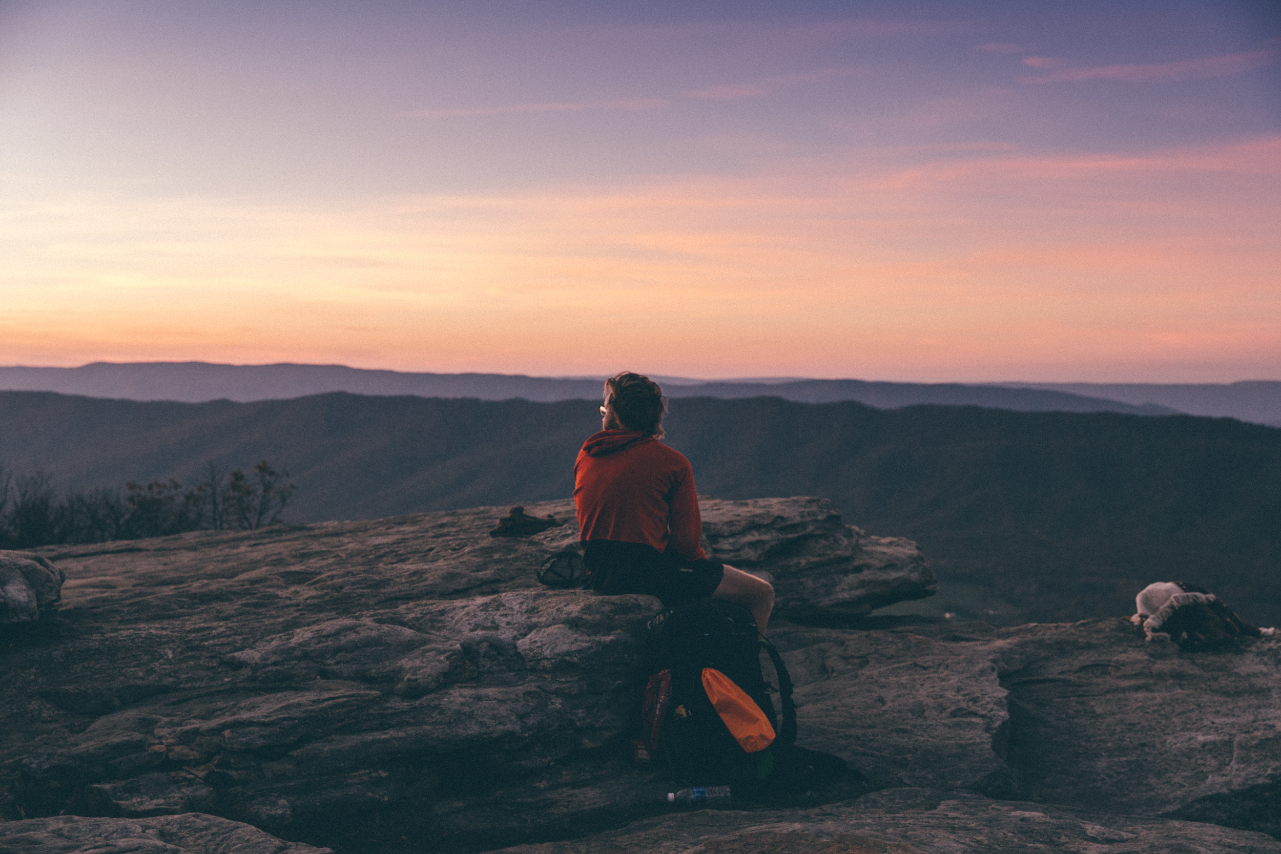
A flat rock ledge juts over the Catawba Valley at 3,197 feet elevation — a diving platform into the air. The most photographed overlook on the entire 2,190-mile Appalachian Trail. The vista offers a 270-degree sweep: the Catawba Valley drops 1,600 feet below, North Mountain rises to the west, the Tinker Cliffs north, the Roanoke Valley east. The feature is named after James McAfee, a Scottish-Irish immigrant who settled in the Catawba Valley in the late 1730s. The hike from the AT parking area on Route 311 is 4.4 miles one way with 1,700 feet of elevation gain. Moderately difficult with a gradual incline. The trail ends on rocky mountain terrain that sticks out like the ledge it is. Picnic tables and resting spots throughout. The average round trip takes four to four and a half hours. Most popular in spring and fall. There has been an average of around 100 hikers on the trail at once. Parking fills early on weekends. Start before 8 AM in peak season. Thru-hikers consider this the emotional midpoint of the Virginia section. The overlook appeared prominently in the 2015 film *A Walk in the Woods*, starring Robert Redford and Nick Nolte, and is on the movie's poster. The ridge line is covered in a pine forest. Much of Catawba Mountain was open farmland in the mid-1900s. Maximum group size for day hikes is 25. Dogs must be kept on leash. Camping is prohibited at the overlook itself.
 2Nature & Parks·1936Tinker Cliffs
A mile-long ridgeline at 3,000 feet with 270-degree views of the Catawba Valley — one leg of the Virginia Triple Crown alongside McAfee Knob and Dragon's Tooth. The 4-mile out-and-back from Scorched Earth Gap on the Appalachian Trail draws a fraction of McAfee's traffic for the same scope of view. Roanoke sits in the valley below, a city that exists because of location. The Great Wagon Road and Carolina Road — colonial routes that developed from Native American trails — once intersected near what would become downtown. Scotch-Irish settlers arrived in the 18th century following the Plantation of Ulster, then Germans came south from Pennsylvania along those same roads. In 1882, the Norfolk and Western Railway chose the small town of Big Lick as its headquarters. Within two years the town had become the City of Roanoke; in the 1880s alone, the population grew by 22 times. Now the city markets what the railroad couldn't ship: the Blue Ridge itself. The cliff face catches afternoon light — visit late for photography. Trailhead on Route 779, Catawba Valley Drive. Free parking.
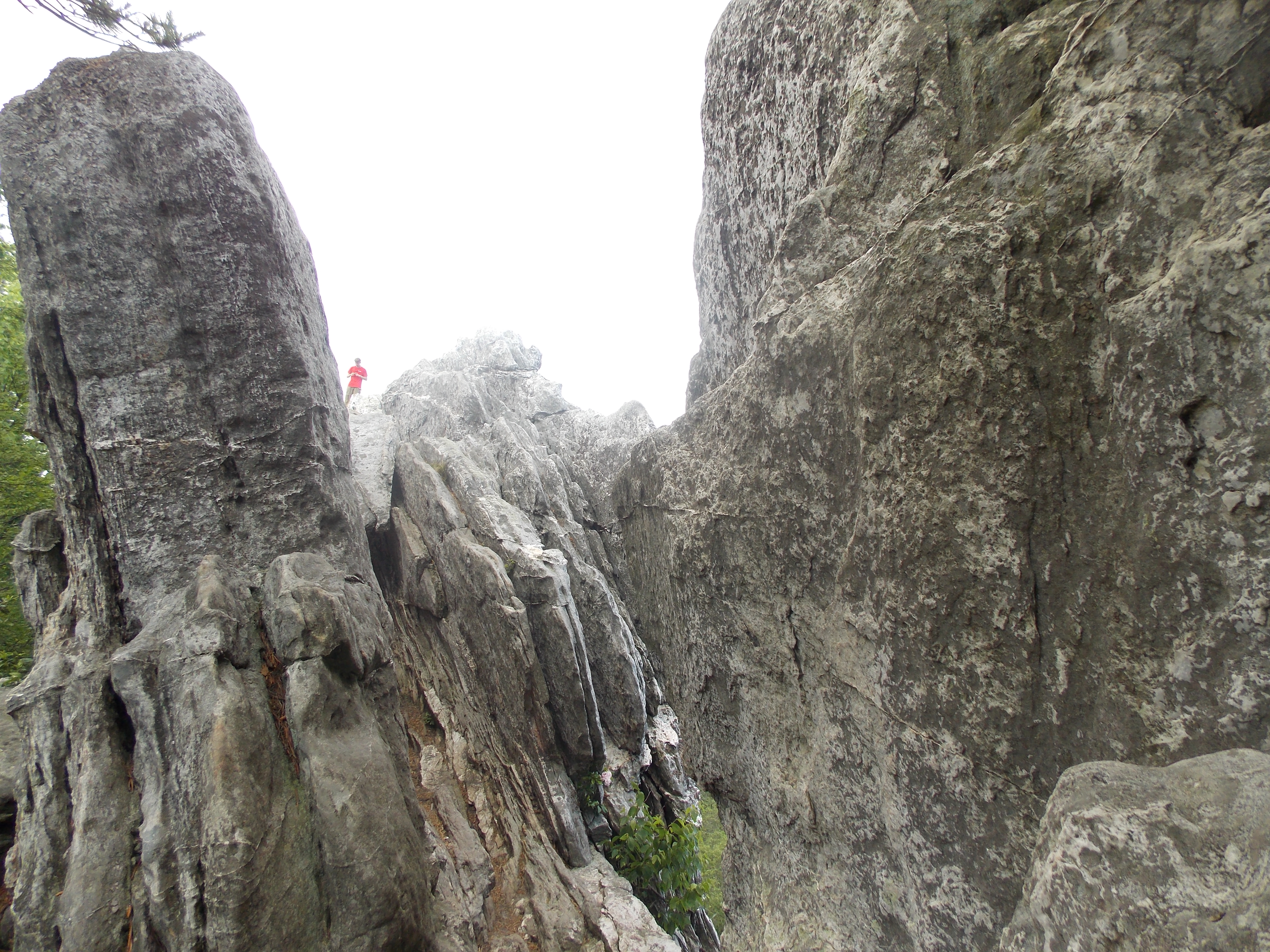
- 3Nature & Parks·1936Dragon's Tooth
Roanoke sits in the Blue Ridge because the mountains were already here when the railroads arrived—a city built in the lap of older geology. The Dragon's Tooth is what that geology looks like when it refuses to settle: a 35-foot spire of Tuscarora sandstone jutting from the ridgeline like a broken tooth, the kind of feature that makes you wonder what the rest of the jaw looked like before erosion had its way. This is the most technical of the Virginia Triple Crown hikes. The 4.6-mile round trip from the Route 311 trailhead comes with significant elevation gain, and the summit scramble requires hands on rock. The final approach is exposed—not recommended for those with vertigo. You are committed to the stone, and the stone does not care. The reward is a 360-degree view from a rock pillar that feels like the edge of the world. You stand where the ridge cracked and a single tooth of sandstone stayed standing. What you see from the top is the same range that shaped Roanoke's location, that determined where the rails would go, where the city would form. The Dragon's Tooth doesn't care about any of that. It was here first, and it will be here when the trails wash out. You go because it's still there, still sharp, still asking you to put your hands on it and climb.