The Civil War in the lower Mississippi was a siege war. Whoever held the river held the Confederacy in half. This 9-stop corridor moves north through the contested ground — the British-Spanish prequel at Galvez, the 48-day Port Hudson siege, the Centenary cemetery, the Confederate artillery position at Grand Gulf, and Vicksburg, where the river finally fell.
The route
 1Military·1779Bernardo de Gálvez — The Battle of 1779
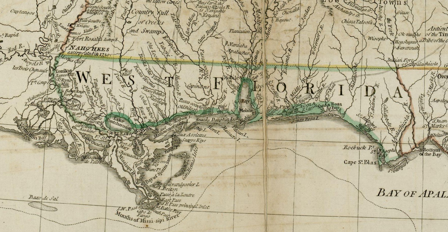
In September 1779, Spanish governor Bernardo de Gálvez intercepted a secret communication from King George III to General John Campbell at Pensacola. The British crown had instructed Campbell to organize an attack on New Orleans—to assemble fighting ships from Jamaica, gather provincial forces, recruit loyal Indians, and draw on the royal treasury. Gálvez read the letter and mobilized Louisiana for war. On September 21, 1779, Gálvez's forces defeated the British at Baton Rouge. He took Natchez weeks later, then Mobile in March 1780. On May 8, 1781, he captured Pensacola, the British capital of West Florida, from Campbell. The British lost every base on the Gulf coast. Gálvez had been appointed governor of Louisiana in 1777 with instructions to secure the friendship of the United States. The British blockade of the Thirteen Colonies had closed the Atlantic ports; the Mississippi River became the alternative. Working with Oliver Pollock, an American patriot, Gálvez shipped gunpowder, muskets, uniforms, and medicine upriver to the colonial rebels. His Gulf campaign kept British forces from outflanking the Revolution from the west. Congress issued a resolution on May 9, 1783, to display his portrait in the room where Congress met. The portrait was not hung until December 2014—the same year Congress granted Gálvez honorary citizenship, making him one of eight people ever so honored. Galveston, Texas, is named for him.
 2Military·1863·NHLPort Hudson State Historic Site
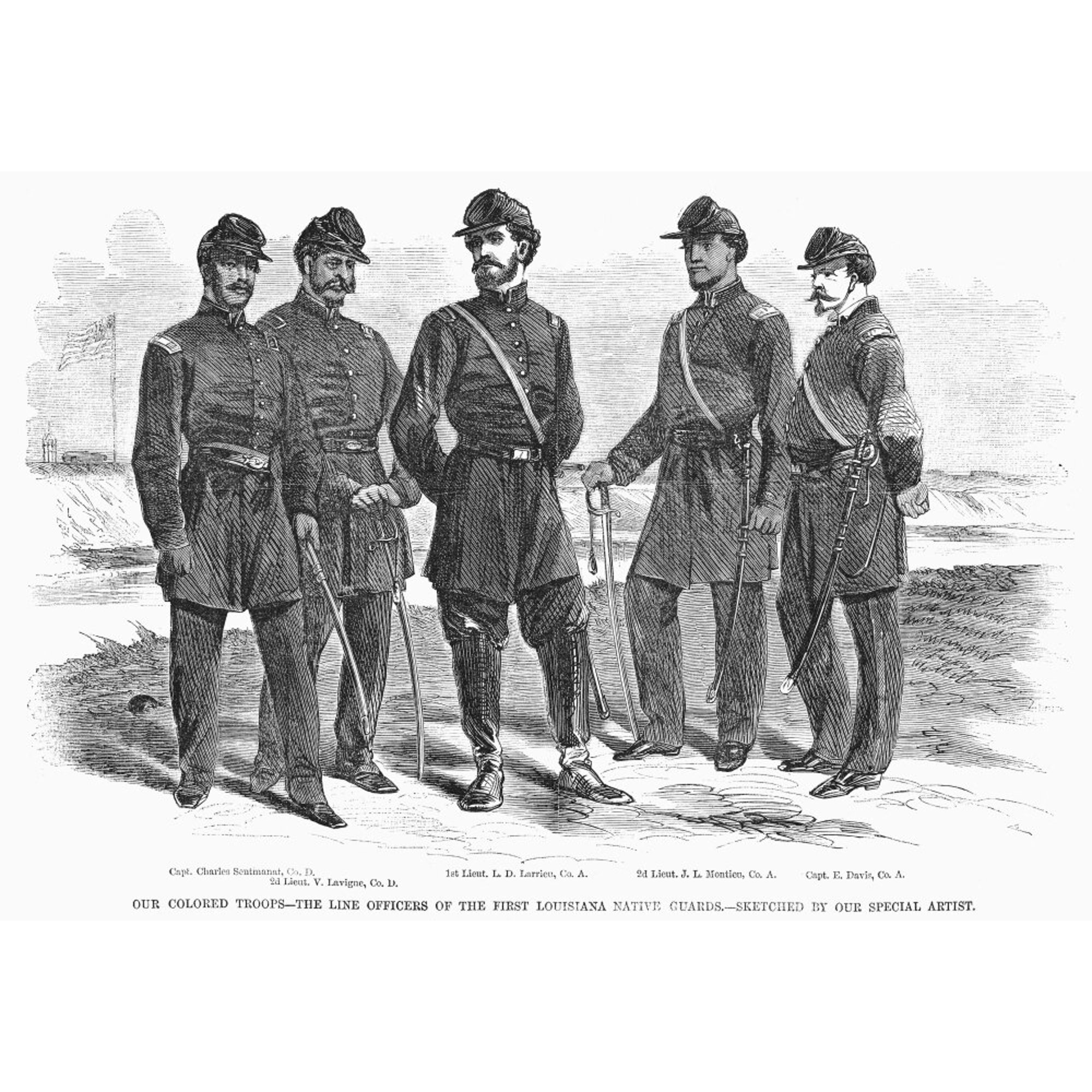
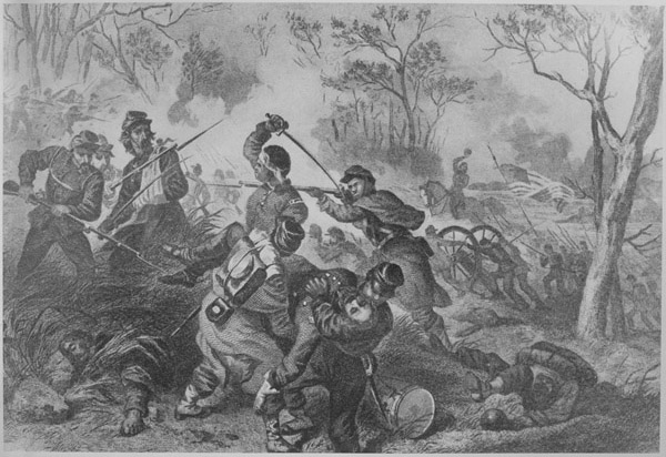
The longest siege in American military history—forty-eight days—ended here on July 9, 1863, when Confederate General Franklin Gardner surrendered after learning Vicksburg had fallen. The Union now held the Mississippi River without contest, the Confederacy split in two. What remains on the ground are six miles of original earthworks and rifle pits, trenches dug into terrain that forms a natural terrace sixty-five to eighty feet above Thompson Creek and Sandy Creek. The twisting, steep ground made this a defensible position; Union forces under Major General Nathaniel Prentice Banks ringed the Confederate positions and settled in for weeks of attrition. On May 27, the 1st and 3rd Louisiana Native Guards—units composed entirely of African Americans, among the first to include African-American field commanders—were ordered to attack Confederate batteries south of Foster Creek. There was doubt in Union circles about how these men would perform. They reached to within fifty feet of the Confederate guns three times before being repulsed. Of just over a thousand deployed, thirty-seven were killed, one hundred fifty-five wounded, one hundred sixteen missing. They held the field until ordered to retreat at four in the afternoon. The site was designated a National Historic Landmark in 1974 for this reason: it was the first place African-American military units fought for the Union under African-American field leadership. The interpretive center, artillery displays, and redoubts trace the siege's arc. Historical reenactments are held each year. The trails are shadeless—bring water and start early. Port Hudson National Cemetery, where many of the dead were buried, lies six miles south.
 3Military·1863·NHLFort Desperate — Port Hudson
Confederate soldiers named this position themselves: Fort Desperate. The southernmost defensive line at Port Hudson, it held against repeated Union assaults during the 48-day siege that ran from May 22 through July 9, 1863. The name tells you what they knew about their odds. On the morning of May 27, General Nathaniel Prentice Banks ordered two units composed entirely of African Americans—the 1st and 3rd Louisiana Native Guards—to attack the Confederate positions south of Foster Creek. These were among the first units to include African-American field commanders, and there was question in Union military circles about how they would perform. The units reached to within 50 feet of the Confederate batteries three times before being repulsed. Out of just over 1,000 men deployed, 37 were killed, 155 wounded, and 116 went missing. They remained in the field until ordered to retreat at 4:00 pm. The siege was part of a concerted Union effort to gain full control of the Mississippi River. It ended only when Confederate General Franklin Gardner surrendered after learning of the fall of Vicksburg. The earthworks here are among the best-preserved fortifications from the siege. In 1974 the site was designated a National Historic Landmark, significant as the first place where African-American military units fought for the Union Army under African-American field leadership. Walk the interpreted trail at the Port Hudson State Historic Site to read Fort Desperate in context—the redoubts, the artillery displays, the museum about the longest siege in American history.
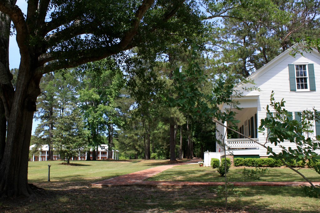
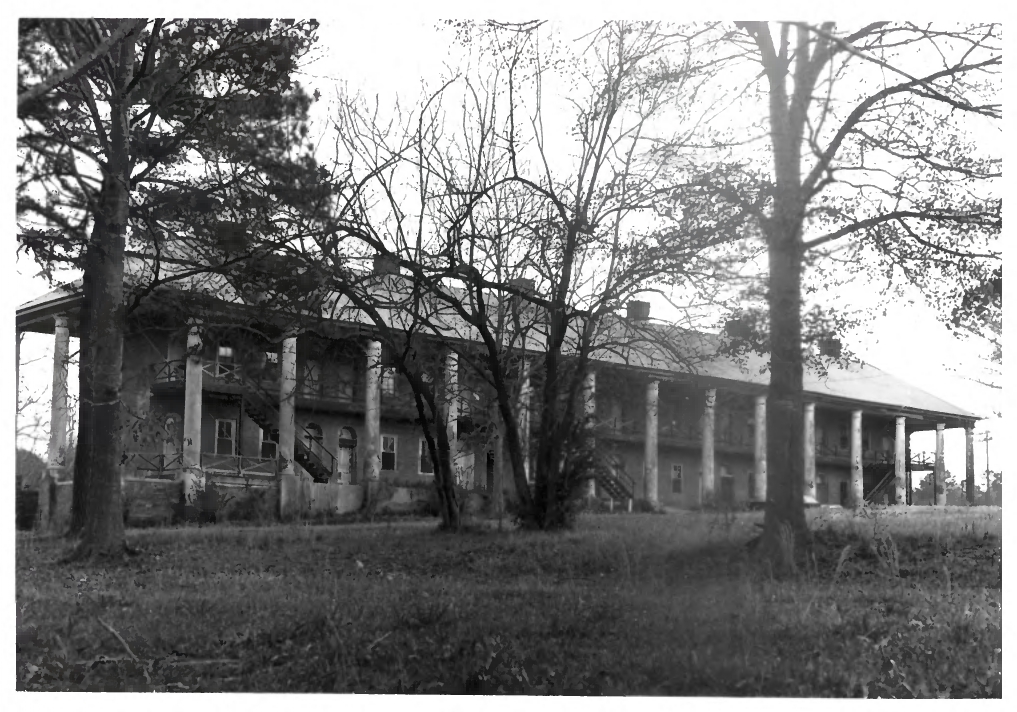 4Historic Site·1825·NRHPCentenary State Historic Site
The original college building stands in Jackson, Greek Revival and intact. Centenary College operated here before moving to Shreveport in 1908. During the Civil War, the campus served as a Confederate hospital. After the war, it became a state school for the blind for nearly a century. Jackson has 124 structures listed on the National Register of Historic Places — one of Louisiana's best-preserved antebellum commercial corridors. The landmark sits within a town that kept its built fabric. You're not visiting a single monument; you're walking into a place where the whole commercial grid survived.
 5Military·1863Battle of Jackson Marker
On August 3, 1863, with Port Hudson fallen, Union Gen. William Emory led a raid to cut the rail junction that had been supplying Confederate forces. The fight swept through Jackson. The East Feliciana Parish Courthouse became, briefly, a Union command post — a building meant for land records and probate now holding field maps and dispatch runners. The marker stands a block from that courthouse, in the historic district where Greek Revival storefronts still line the commercial streets. The plaque tells you the date and the stakes. The courthouse tells you what it cost to have your county seat turned into someone else's war room. Walk the district after — the buildings that survived are the reason to come.
 6Religious Site·1861–1865Centenary Confederate Cemetery
A college dormitory where Methodist students slept became a hospital ward where Confederate soldiers died. Centenary College closed its doors in 1861; the buildings didn't stay empty long. Eighty-five men are buried here — some with names on stones, some without — all of whom died from wounds or disease inside what had been student housing two years earlier. The cemetery sits on the same campus ground the college once occupied, a short walk from the Centenary State Historic Site. You need both to understand what happened: the site shows you the building that shifted from educating ministers to treating the dying, and the cemetery shows you where that shift ended. The graves are the punctuation on a sentence the college never intended to write.
 7Architecture·c. 1820–1860·NRHPJackson Historic District
Jackson incorporated in 1825 as East Feliciana Parish's original seat, and the bones of that moment are still there: 124 structures listed on the National Register, many clustered along streets that haven't moved since the 1820s. The Old Centenary Inn and former college buildings anchor the downtown core. Centenary College of Louisiana opened here in 1825, holding classes in Jackson for eighty-three years before relocating to Shreveport in 1908. For most of the nineteenth century, this was a working parish seat with a working college — administrative offices, lecture halls, boarding houses, all within walking distance of each other. The Republic of West Florida Historical Association Museum on Charter Street is a worthwhile short stop if you want the parish's longer backstory. What you get here is a rare thing: a small Louisiana town that looks like what it was, not what developers wished it could become.
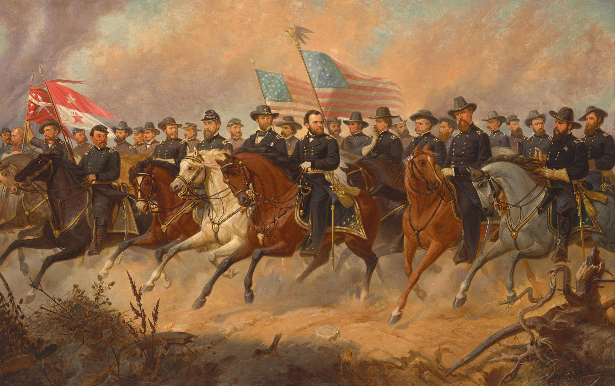
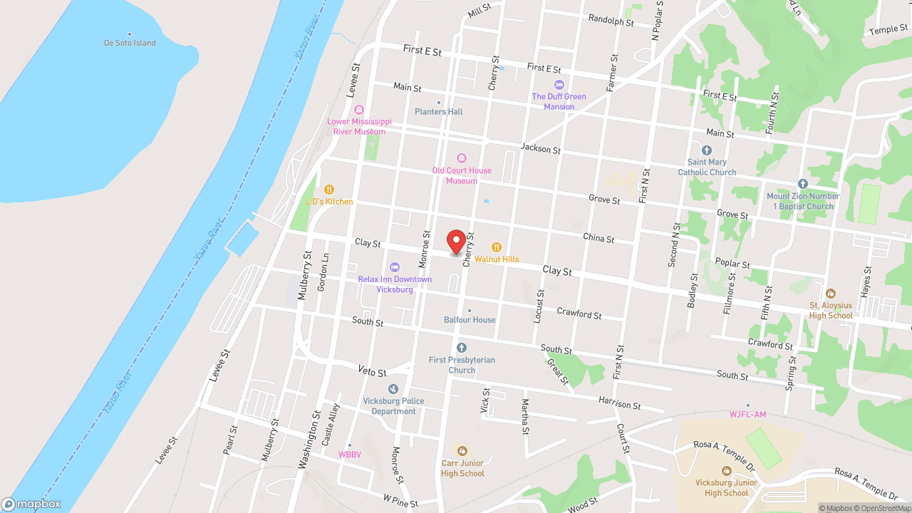 8Museum·2021Vicksburg Civil War Museum
Lincoln called Vicksburg "the key to the war," and for more than a century and a half, the city's museums told the siege's story from a narrow angle. Charles Pendleton changed that in spring 2021, opening the first Civil War museum in the United States owned by an African American. The collection at 1123 Washington Street—housed in the former Corner Drug Store building—includes original Confederate states' letters of secession, but its real work is recovery: surfacing African American contributions to a conflict that Vicksburg's other institutions have largely erased. The siege ran from May 18 to July 4, 1863. Grant's forces drove Pemberton's Confederate army into Vicksburg's defensive lines and settled in for more than 40 days until the garrison, supplies nearly gone, surrendered. The city was the last major Confederate stronghold on the Mississippi River. Its fall split the Confederacy in two. What happened here decided the war's outcome, but who fought—and what they fought for—depends on which museum you walk into. Pendleton's is privately owned and operated as a nonprofit. Open daily; check hours before visiting.