Lake Charles has been rebuilding itself out of whatever it could sell next for 130 years. The 1911 City Hall went up while the sawmills were still running. The 1912 courthouse spent the profits. The Imperial Calcasieu Museum carries the longer arc — Atakapa-Ishak presence, lumber, sulphur, oil — and the hurricanes (Rita 2005, Laura 2020) that keep editing the skyline before the residents finish moving back in. Bord du Lac, French for edge of the lake, is still where the city negotiates with the water that named it.
The route
 1Museum·1911·NRHP1911 Historic City Hall Arts & Cultural Center
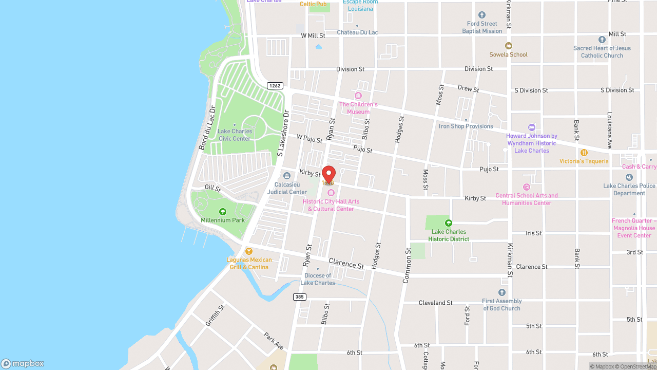
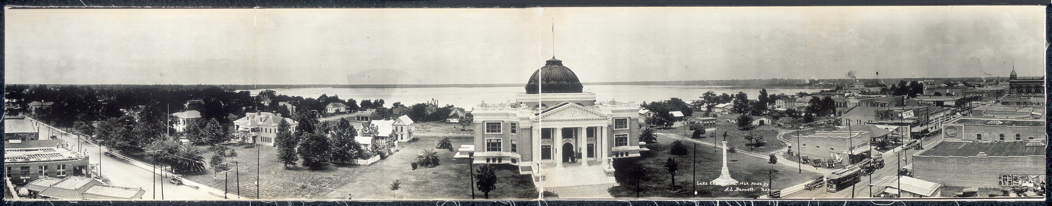
The Great Fire of April 1910 burned through Lake Charles. In 1911, the city built a new city hall — three stories, Romanesque Revival arches, pressed-tin ceilings, terrazzo floors. It held the mayor's office and the city's administrative machinery until 2004, when it became an arts center. It's listed on the National Register of Historic Places. Three floors of galleries now occupy what were once municipal offices. The Black Heritage Gallery and Gallery by the Lake anchor the programming, with rotating exhibitions in additional rooms. The original architectural details remain: terrazzo underfoot, pressed tin overhead, arches framing the passages between galleries. Lake Charles has been rebuilt more than once. The fire in 1910. Hurricane Rita in 2005. Hurricane Laura in 2020 — Category 4, with sustained winds of 150 miles per hour and a gust in the city of 137. Hurricane Delta followed weeks later. Afterward, the city was described as if "20 tornadoes came in and wiped the city." This 1911 building still stands. The building itself is the exhibit. Free admission. 1001 Ryan Street, downtown.
 2Museum·1963Imperial Calcasieu Museum
The Sallier Oak stands on the museum grounds, over 300 years old—older than Lake Charles itself. The city was founded in 1861 as Charleston, named for Charles Sallier, the early settler. The street that runs past the tree carries his name. The Imperial Calcasieu Museum opened in 1963 as the regional keeper for five parishes: Calcasieu, Cameron, Beauregard, Allen, and Jeff Davis. The permanent collections trace what came out of this ground—lumber, sulphur, oil—and who was here before extraction began. The Atakapa-Ishak get a gallery. So does the lumber era. So does sulphur mining. The museum rotates fine art exhibitions alongside the artifacts, but the through-line is what southwest Louisiana made and endured. Lake Charles sits on a level plain 30 miles from the Gulf of Mexico, about 13 feet above sea level. The city was devastated by the Great Fire of April 1910. It grew during and after World War II when petrochemical refineries arrived. In 2005, Hurricane Rita hit hard. In 2020, Hurricane Laura battered the city with sustained winds of 150 miles per hour—the National Weather Service called the storm surge "unsurvivable." Hurricane Delta followed weeks later. Locals described the aftermath as if "20 tornadoes came in and wiped the city." The oak is still standing. The museum is still open. You go to see what a place keeps when it sits in the path of the Gulf, in what ties as the most humid city in the contiguous United States, with every reason not to keep anything at all.
 3Nature & ParksLakefront Promenade
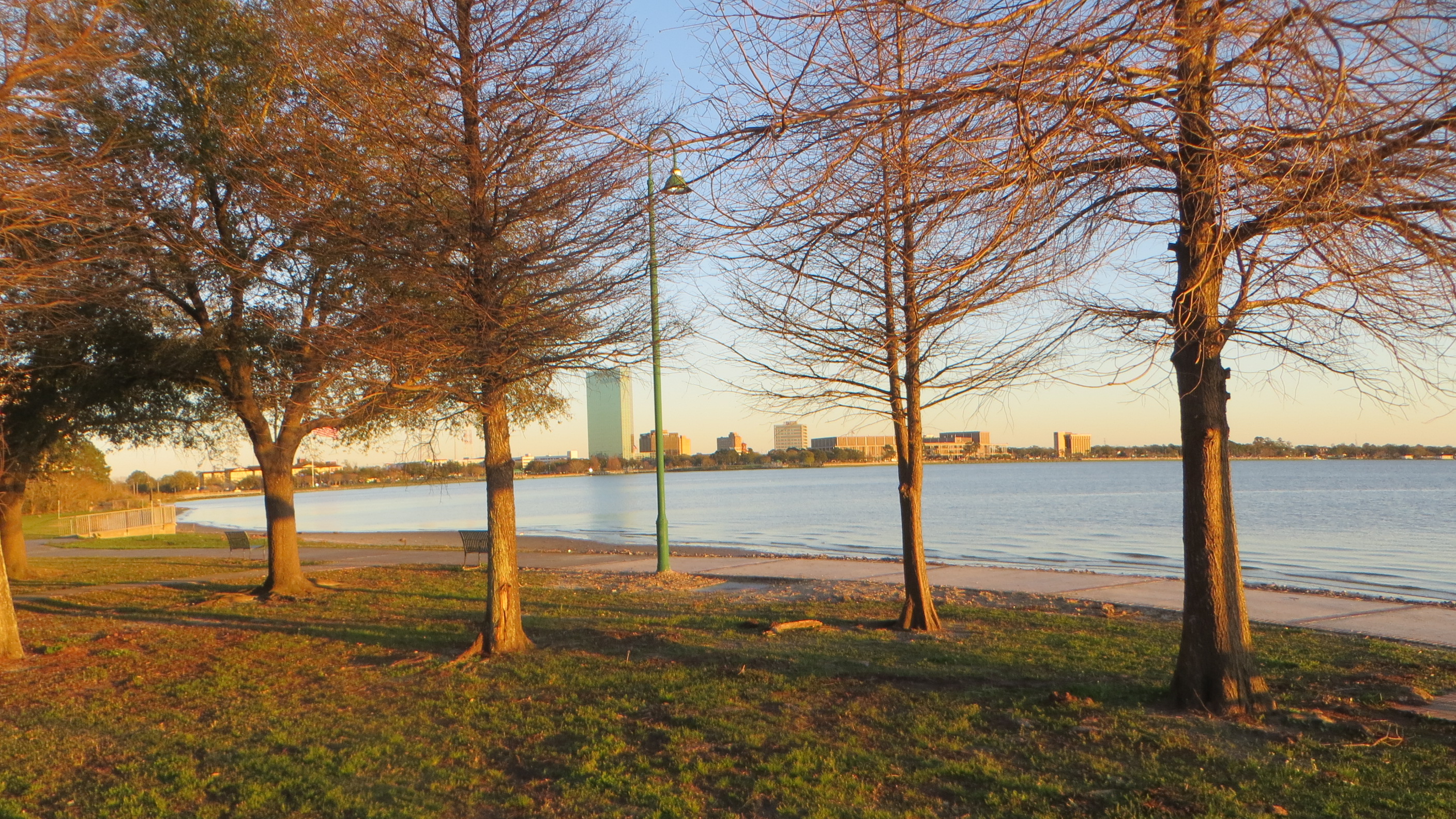
A paved path runs along the north shore of the lake that gave the city its name—incorporated first as Charleston in 1861 after early settler Charles Sallier, then reincorporated as Lake Charles in 1867. The Lakefront Promenade connects Bord du Lac Park to North Beach, open daily and free. Walk or ride a bike. The view south frames both identities: the lake itself, and across the water, the Calcasieu Ship Channel—the deep-water route that allows ocean-going vessels to sail up from the Gulf of Mexico—and the industrial corridor beyond. Petrochemical refineries arrived during and after World War II, transforming the city into a refining center. Before that, oak and pine trees dotted the landscape, and lumber was the main economic engine. Lake Charles has been battered. Hurricane Rita in 2005. Laura and Delta in 2020, when the city was described as if "20 tornadoes came in and wiped the city." Actual tornadoes in 2021 and 2024. The promenade remains, a daily-use amenity where joggers, cyclists, and walkers share the waterfront. Best at sunrise or sunset, when the light crosses the lake at an angle. The city sits on a level plain about thirty miles from the Gulf, elevation around thirteen feet—tied with Port Arthur and Astoria as the most humid city in the contiguous United States. Morning humidity averages 90 percent. The water is rarely far from anything here.
 4Nature & ParksBord du Lac Park & Marina
The French name announces the premise: *bord du lac* — edge of the lake. And here it is — a waterfront park with a splash pad, playground, marina, fishing piers, and a pavilion that hosts crawfish boils and outdoor concerts. Free admission, open green space, access to the water. Lake Charles sits on the Calcasieu River, bordered by Lake Charles and Prien Lake, threaded with bayous. The Calcasieu Ship Channel brings ocean-going vessels up from the Gulf. Since World War II, the city has been defined by petrochemical refining — an industrial center built on water access. This park occupies a different function: public waterfront, not industrial waterfront. A place where the lake is something you swim in, fish from, tie a boat to. The park sits adjacent to the Lakefront Promenade and North Beach. On event nights, the pavilion fills — community gatherings, concerts, the kind of crawfish boils that anchor a Gulf Coast summer. The rest of the time, it's families with kids at the splash pad, anglers working the piers, boats coming and going from the slips. What makes it worth the visit is the proposition itself: a city known for refineries kept this stretch of shoreline open and public. The lake is right there. You can walk to it.