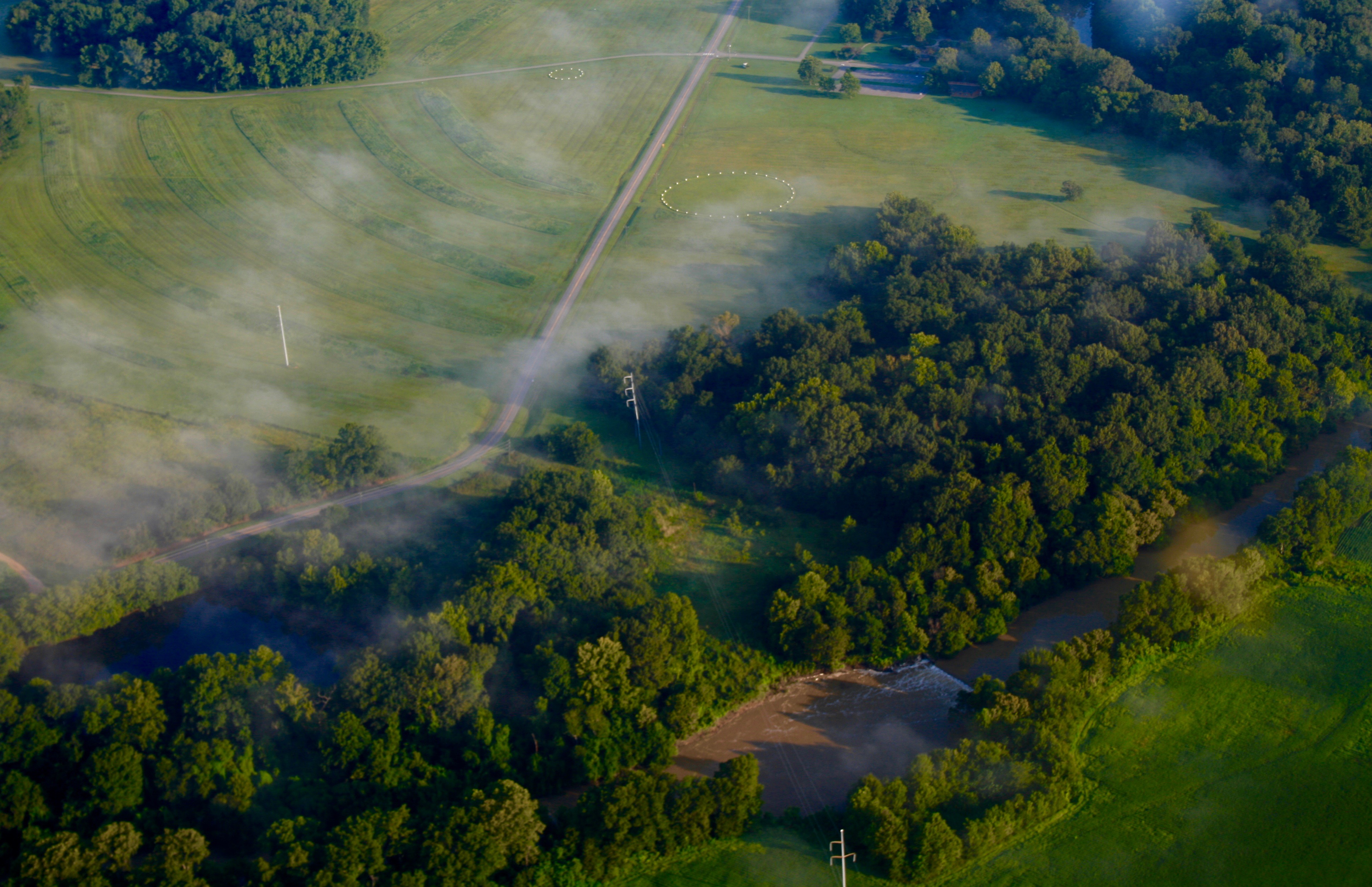
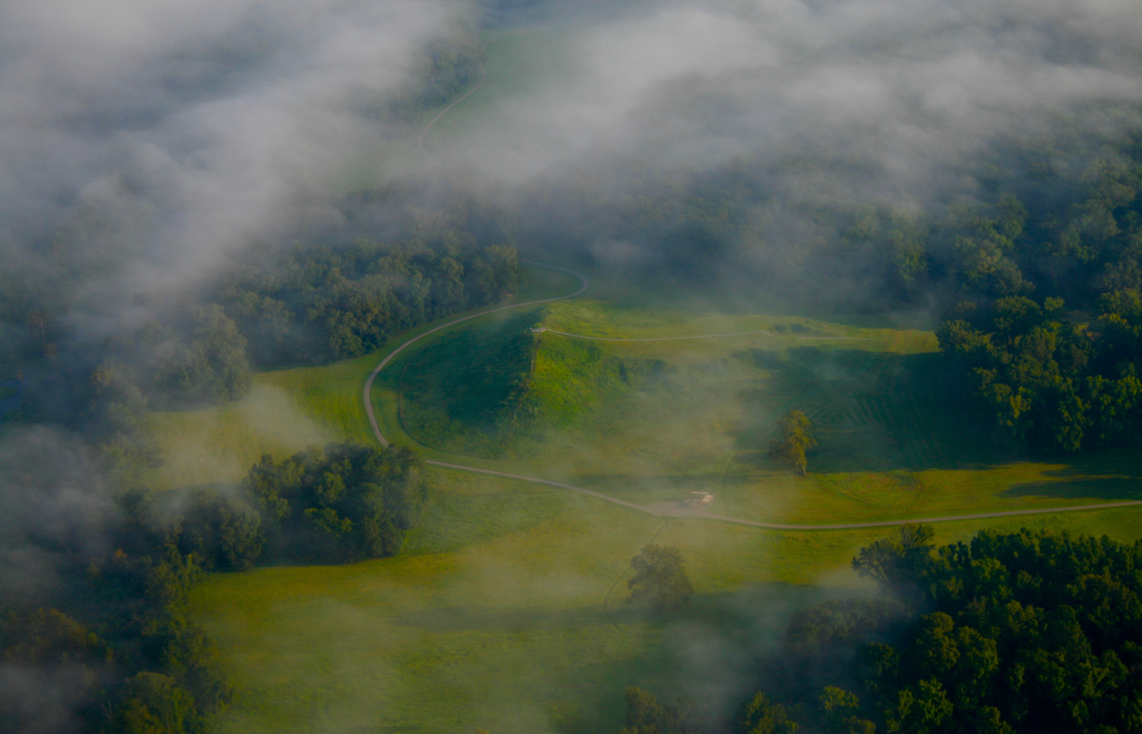
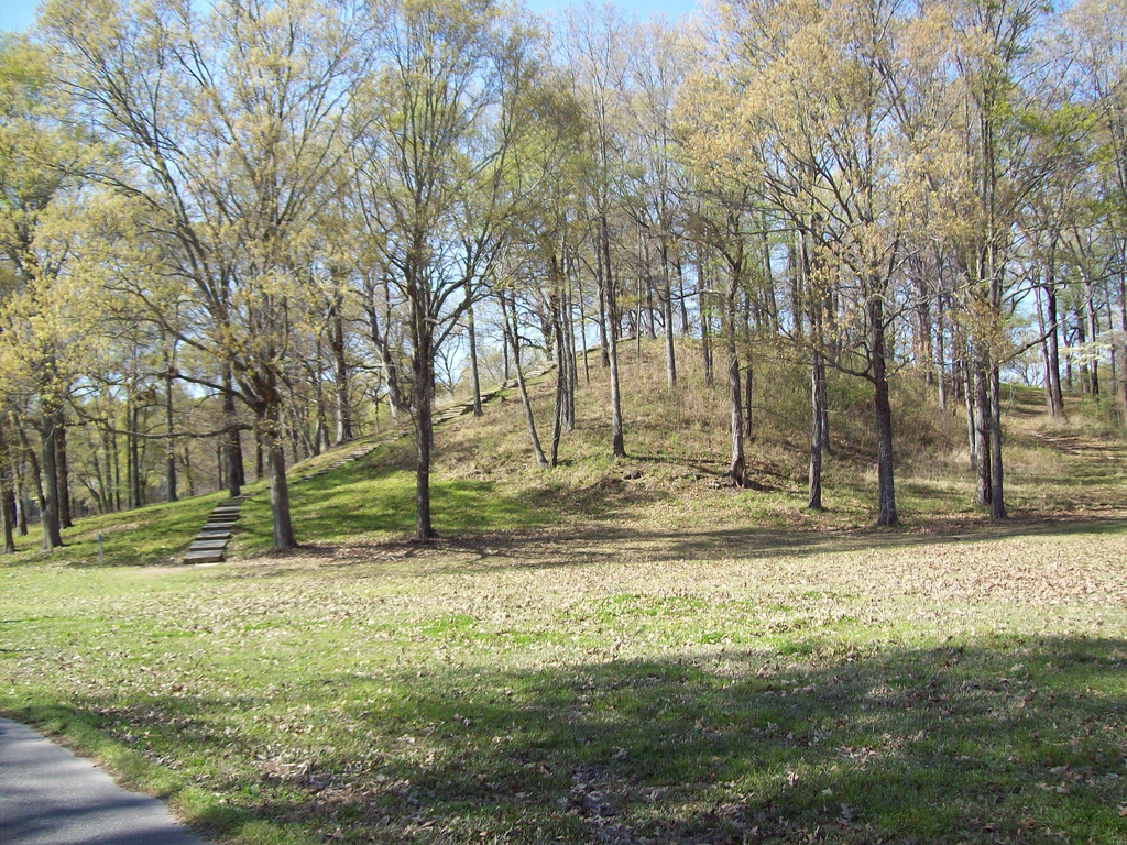
# PART 1 — SOURCE TRACE 1. Six concentric C-shaped ridges, unique to Poverty Point ← Wikipedia: "The earthworks include six concentric, C-shaped ridges"; "These concentric ridges are unique to Poverty Point" 2. Built 1700–1100 BCE ← key_facts + Wikipedia: "built by indigenous people between 1700 and 1100 BCE during the Late Archaic period" 3. Outermost ridge three-quarters of a mile in diameter ← Wikipedia: "The approximate diameter of the outside ridge is three-quarters of a mile" 4. Scale invisible until aerial photography ← Wikipedia: "The scale of the ridges is so massive that it wasn't until researchers examined aerial photographs that they were able to recognize the geometric design" 5. Hunter-fisher-gatherers ← Wikipedia: "The people of the Poverty Point culture who constructed the earthworks were hunter-fisher-gatherers rather than agriculturalists" 6. Complex hunter-gatherer monument builders ← Wikipedia: "They are an example of a complex hunter-gatherer society that constructed large-scale monuments" 7. No naturally occurring stone ← Wikipedia: "There is no naturally occurring stone at Poverty Point" 8. Materials from Ohio Valley, Ozarks, Tennessee, Appalachians ← Wikipedia: "projectile points were made from raw materials naturally occurring in the Ouachita and Ozark mountains, and in the Ohio and Tennessee river valleys"; "soapstone from the southern Appalachian Mountains" 9. Mound A: 8.4 million cubic feet, second-largest in eastern North America ← Wikipedia: "8,400,000 cubic feet (238,000 cubic meters) of fill, making it the second-largest earthen mound (by volume) in eastern North America" 10. Built in less than three months ← Wikipedia: "Mound A was constructed quickly, probably over a period of less than three months" 11. Baskets held 30–50 pounds ← Wikipedia: "The baskets, depending on the size of the bearer, could hold between 30–50 lb" 12. UNESCO 2014 ← key_facts: "Inscribed as UNESCO World Heritage Site in 2014" --- # PART 2 — PROSE The geometry didn't reveal itself until researchers examined aerial photographs in the mid-twentieth century. Six concentric C-shaped ridges — a design unique to Poverty Point — arc across three-quarters of a mile at their outermost diameter. Between 1700 and 1100 BCE, hunter-fisher-gatherers built them basket-load by basket-load, loess dirt dumped in piles and gaps filled in. The baskets held 30 to 50 pounds depending on who carried them, suggesting men, women, and children worked the earthworks together. What they built without agriculture, without draft animals, without naturally occurring stone, was a monumental landscape. Mound A alone contains 8.4 million cubic feet of fill and was raised in less than three months — no construction phases, no weathering between efforts, just a single sustained push. It is the second-largest earthen mound by volume in eastern North America. The people who built it ate deer and possum, fish and turtle, nuts and aquatic roots. They imported materials across distances that defy the scale of a settlement: stone tools from the Ouachitas and Ozarks, soapstone vessels from the southern Appalachians, copper and galena from as far as the Great Lakes drainage. Excavations in the 1970s revealed wooden post circles in the plaza, some over 200 feet across. Radiocarbon dates bracket ridge construction between 1600 and 1300 BCE. The record does not explain why they built it, only that they did, and that the effort was immense and deliberate and organized across generations. UNESCO inscribed Poverty Point as a World Heritage Site in 2014. The interpretive museum, trails, and guided tours are open year-round. Stand on the ridges and you are standing on something that required coordination, labor, and vision from people who had no written language and left no descendants we can name. What remains is the thing itself: dirt shaped into intent, still holding the line after thirty-three centuries.
- ·Inscribed as UNESCO World Heritage Site in 2014
- ·Six concentric ridges and five mounds built 1700–1100 BCE
- ·Builders imported materials from as far as the Ohio Valley and Appalachians
- ·National Historic Landmark and National Monument
- ·Museum, guided tours, and interpretive trails open year-round
Memories
Nearby
Editorial content compiled with AI assistance. Place details verified against public records.