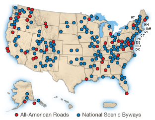
Cameron Parish is the part of Louisiana that has never been settled, only crossed. The Atakapa-Ishak used these marshes as a highway between prairie and Gulf for thousands of years, and the 98-mile loop still moves the way they did. Sabine's 1.5-mile boardwalk puts alligators at railing height. Pintail Drive runs three miles of Cameron Prairie's freshwater marsh from the driver's seat. Peveto Woods is the first substantial stand of trees songbirds find after crossing the Gulf. Holly Beach is a working coast, not a resort. One of only 31 All-American Roads in the country — the designation is for the road, not the view.
The route
 1MuseumCreole Nature Trail Adventure Point
The visitor center sits at the northern gate of the 180-mile Creole Nature Trail All-American Road in Sulphur, where the road begins its run south toward the Gulf of Mexico. Interactive exhibits walk you through the four ecosystems you'll encounter on the drive — marsh, prairie, beach, and bayou — that form the coastal plain stretching to the gulf. A live alligator exhibit shares floor space with Cajun cooking smell stations, sensory anchors for what the land produces and what lives in it. Lake Charles, the city that anchors the trail, is shaped by water. The Calcasieu River, the Calcasieu Ship Channel, Lake Charles and Prien Lake, Contraband Bayou, Henderson Bayou, English Bayou — all of it flows through level ground thirty miles inland from the gulf. The city is tied with Port Arthur, Texas, and Astoria, Oregon, as the most humid in the continental United States: 90 percent relative humidity in the morning, 72 percent in the afternoon, 57 inches of rain a year. The wetlands you're about to drive through are not an attraction engineered for tourists. They are what happens when this much water meets this much land. Admission is free. Pick up maps, birding checklists, and driving directions before you head south. The center exists because the 180 miles of road that follow need context, and because the ecosystems themselves don't self-explain.
 2Nature & ParksSabine National Wildlife Refuge & Wetland Walkway
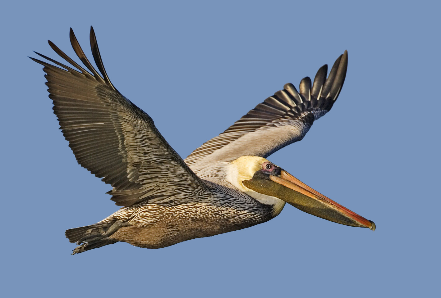
The 1.5-mile walkway delivers what few coastal marsh trails can: alligators at eye level. The refuge holds a very large contingent of American alligators, and the elevated concrete path — with a wooden boardwalk section — puts visitors among them. Roseate spoonbills appear on the species list alongside great egrets, snowy egrets, ducks, geese, Neotropic cormorants, raptors, wading birds, and shorebirds. More than 200 bird species have been recorded here. The walkway sits inside Sabine National Wildlife Refuge, 124,511 acres of coastal marsh — the largest such refuge on the Gulf Coast. The western boundary is Sabine Lake, the inlet for Port Arthur, Texas; the tip of the eastern end reaches Calcasieu Lake. An observation tower and fifteen interpretive stations explain Gulf Coast marshland ecology. A second trail, the Blue Goose Trail, offers a 1-mile round trip with a scenic overlook. Lake Charles rebuilt after the Great Fire of 1910, then again after Hurricane Rita in 2005, and again after Hurricane Laura in 2020. The city has learned to measure duration in decades, not seasons. Sabine took the direct hit from Rita on September 24, 2005. Every office building, visitor center, and maintenance shop at the headquarters was damaged beyond repair and removed, though three structures were later repaired. Recreational areas along Highway 27 — bridges, piers, observation towers, boardwalks — took varying degrees of damage. The refuge reopened for limited fishing and hunting in the 2020–2021 season. West of Highway 27, approximately 32,000 acres of marshes, levees, and canals were damaged; canals and marshes remain clogged with debris from offshore rigs and coastal communities. The walkway is on Louisiana Highway 27, part of the Creole Nature Trail loop, located 4 miles south of the refuge headquarters. No facilities on the trail itself — bring water and sun protection. Admission is free. Approximately 300,000 people visit annually.
 3Nature & ParksCameron Prairie National Wildlife Refuge & Pintail Wildlife Drive
The Pintail Wildlife Drive loops three miles through freshwater marsh — 9,621 acres where you stay in the car and the wildlife comes to you. Alligators sun on the banks. Wading birds stalk the shallows. River otters slip through the water. November through February, when waterfowl migrate down the flyways, the refuge earns its name: this is pintail country, and winter is when you see it at full capacity. The visitor center has exhibits on marsh ecosystems — how water moves, what grows where, what lives in it. The refuge sits on the Creole Nature Trail loop, part of the Southwest Louisiana National Wildlife Refuge Complex formed in 2004. Admission is free. The drive is open year-round, but peak viewing season runs November to February. You don't need boots or binoculars. Roll the windows down. The marsh does the rest.
 4Nature & ParksPeveto Woods Bird & Butterfly Sanctuary
Forty-one acres of trees in a parish where trees do not grow. That's what makes Peveto Woods matter—not the acreage, but the fact that it exists at all on the treeless Cameron Parish coast. The sanctuary is a chenier woodland, a rare island of forest on land that everywhere else offers nothing to break a horizon. Over two million migratory birds pass through here annually. Peak migration runs April through May. They arrive exhausted from their Gulf crossing and fill every branch—warblers, tanagers, buntings, orioles. The sanctuary is one of the most important trans-Gulf migratory bird stopover sites in North America. Lake Charles sits thirty miles inland from the Gulf on a level plain. The city has been battered: the Great Fire of 1910, Hurricane Rita in 2005, Category 4 Hurricane Laura and Hurricane Delta in 2020. A National Weather Service warning called Laura's storm surge "unsurvivable." The city rebuilt each time. What survives here survives hard weather. Peveto Woods is managed by the Baton Rouge Audubon Society. Open dawn to dusk, free. Go in late April when the migrants are desperate and the branches are full.
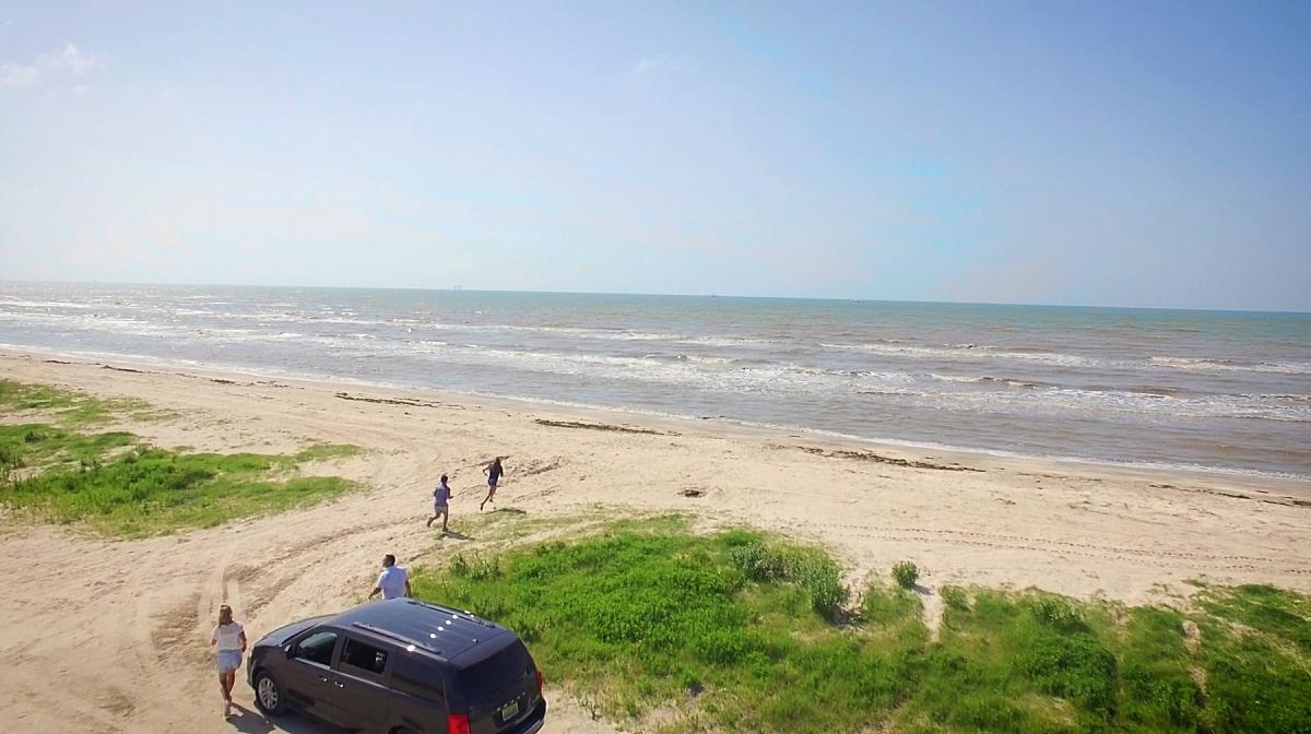
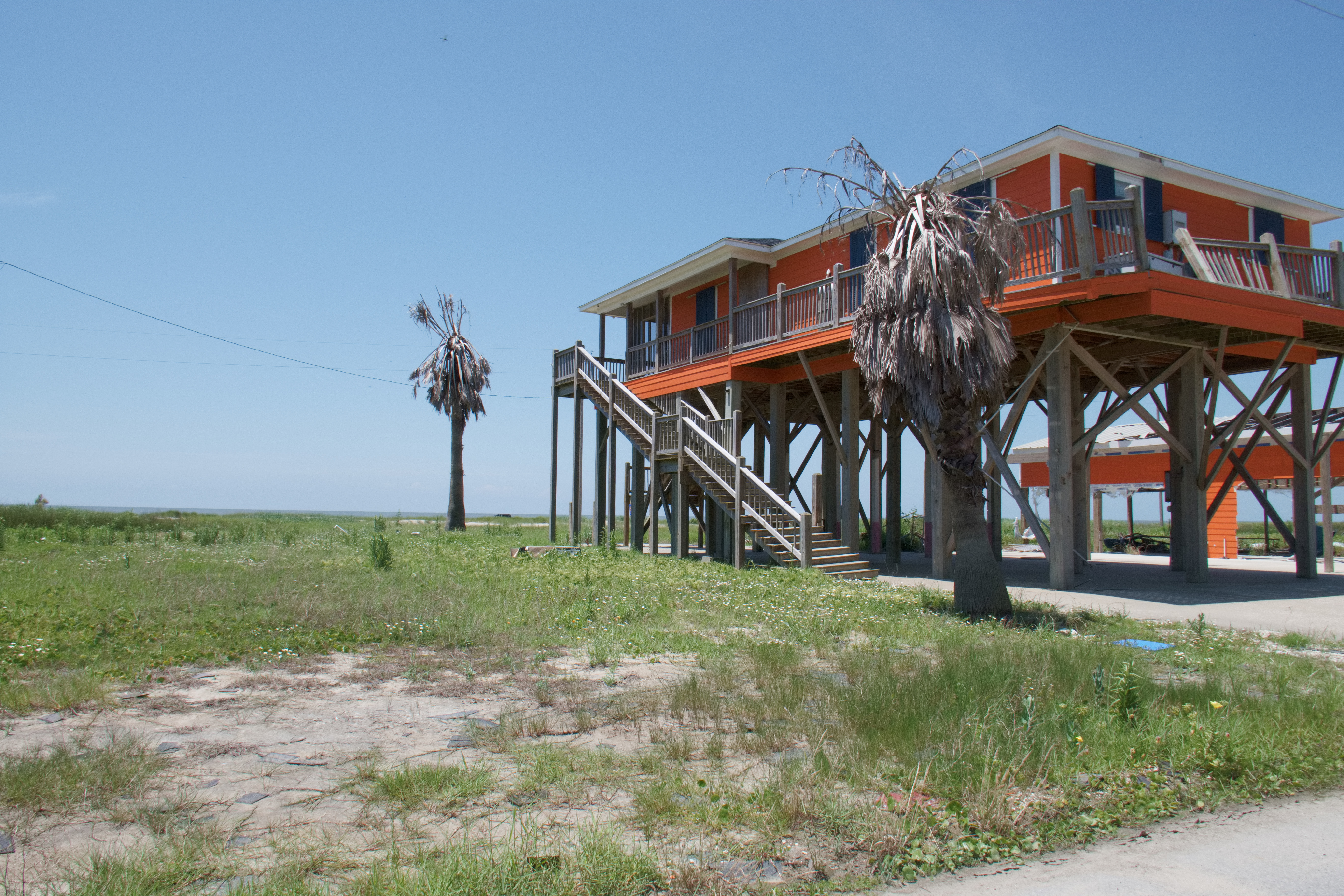 5Nature & Parks·2005Holly Beach — The Cajun Riviera
Holly Beach has been hit by hurricanes again and again. Hurricane Audrey smashed ashore in 1957 with a twelve-foot surge. Rita in 2005 brought ten to fifteen feet, devastating the area. Gustav and Ike reflooded it in 2008. Laura passed through in 2020. After Audrey, several houses were modified so they were taller. The cabins along this stretch were called "camps," and they were built-to-be-rebuilt by residents who understood the threat. By 2006, you had to sign a waiver to live here because the sewer system wasn't functioning. Portable toilets appeared on the roadsides. New structures had to comply with post-Rita building codes. It was feared that the strict codes and high insurance costs would keep the original locals from returning, that the southern part of Cameron Parish would end up with trailer housing indefinitely. Several permanent structures were built anyway. This is the Cajun Riviera—an unincorporated community in Cameron Parish, part of the Lake Charles metropolitan area, with no boardwalk, no hotels, and no admission fee. You can drive on the beach. People come for crabbing, shell hunting, swimming, and bonfires. Services are minimal. Bring everything you need. The cultural importance of Holly Beach—at one time a social and musical hub for vacationing Cajuns—is documented in at least two classic Cajun French songs: Nathan Abshire's "La Valse de Holly Beach" and Lawrence Walker's "Laisse les Bons Temps Rouler," which includes the lyric "I found you in the big marshes / And I brought you to Holly Beach / The mosquitoes are biting / But let the good times roll." Kenny Tibbs and The Jokers recorded a swamp pop parody on Jin Records explaining that Cajun vacationers "ain't got no boardwalk, just got seaweed, but we always pass a real good time at Holly Beach." Holly Beach sits ten miles west of Cameron and twelve miles east of Johnson Bayou. It's part of the Creole Nature Trail loop. The beach is open, the Gulf is there, and people keep coming back.
 6Nature & ParksCreole Nature Trail All-American Road
One of only 43 All-American Roads in the United States — the highest scenic designation a road can earn — the Creole Nature Trail is a 180-mile loop through Cameron Parish that passes four national wildlife refuges. Over 400 bird species have been recorded along the route. Alligators are visible from the road year-round. There are no stoplights. No billboards. The tourism board calls it Louisiana's Outback, and the phrase isn't marketing: 26 miles of undeveloped natural Gulf beach stretch along the route, the kind of coastline that hasn't been subdivided or paved over or wrapped in resort architecture. The road moves through marshland and coastal prairie, through ecosystems Lake Charles was built adjacent to but never fully absorbed into its industrial grid. The full loop takes three to four hours without stops. Plan a full day. The wildlife viewing and beach time are why you're out here — not to pass through, but to pull over and watch what holds still and what doesn't.