Grand Isle is the only inhabited barrier island in Louisiana, and Highway 1 south is the drive that proves the land is borrowed. The road narrows to a ribbon, fishing camps rise on stilts, and 100 miles from New Orleans the pavement runs out at seven miles of Gulf-facing beach. Across Barataria Pass sit the brick ruins of Fort Livingston, begun in 1835 on Grand Terre — the same island where Lafitte ran his Baratarian fleet before Andrew Jackson cut the deal at Chalmette. The tarpon rodeo has run since 1957. The island rebuilds after every hurricane because the fishing is that good.
The route
 1Nature & Parks·TimelessGrand Isle Beach
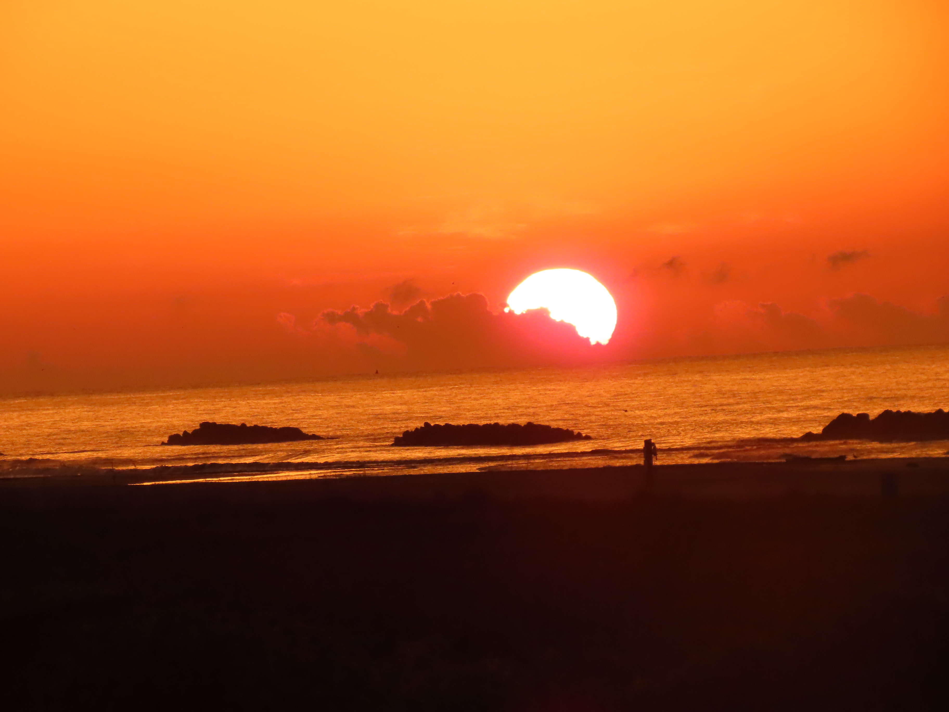
The highway runs 436 miles from Shreveport to the Gulf, and at the southern end it reaches the only sand you can dig your toes into for a hundred miles around New Orleans. Grand Isle sits at the mouth of Barataria Bay — seven miles of public beach on Louisiana's only inhabited barrier island, where fishing piers stretch into open water and Highway 1 finally runs out of road. The drive down covers some of Louisiana's most fragile wetlands, those disappearing acres of marsh and open water that once buffered everything inland. Grand Isle knows what happens when that buffer fails. The island has absorbed Betsy in 1965, Katrina in 2005, Gustav in 2008, and Ida in 2021 — Hurricane Ida's eastern eyewall hit on the sixteenth anniversary of Katrina and damaged every structure on the island. In 2010, oil from the BP Deepwater Horizon spill washed ashore. After each disaster, the beach reopened. Kate Chopin spent her summers here for over a decade. She set *The Awakening* on Grand Isle, and the novel's final scene unfolds on this same stretch of Gulf. In April, the island hosts the Grand Isle Migratory Bird Festival, timed to the spring return of flocks crossing the Gulf from South America. The few remaining chenier forests — old-growth oaks and hackberries on elevated ridges built by Mississippi River sediment — give migrating birds a place to rest. Some of those oaks are over 125 years old. The sand is public. The Gulf is here. That's what you came for.
 2Nature & Parks·1960s–presentGrand Isle State Park
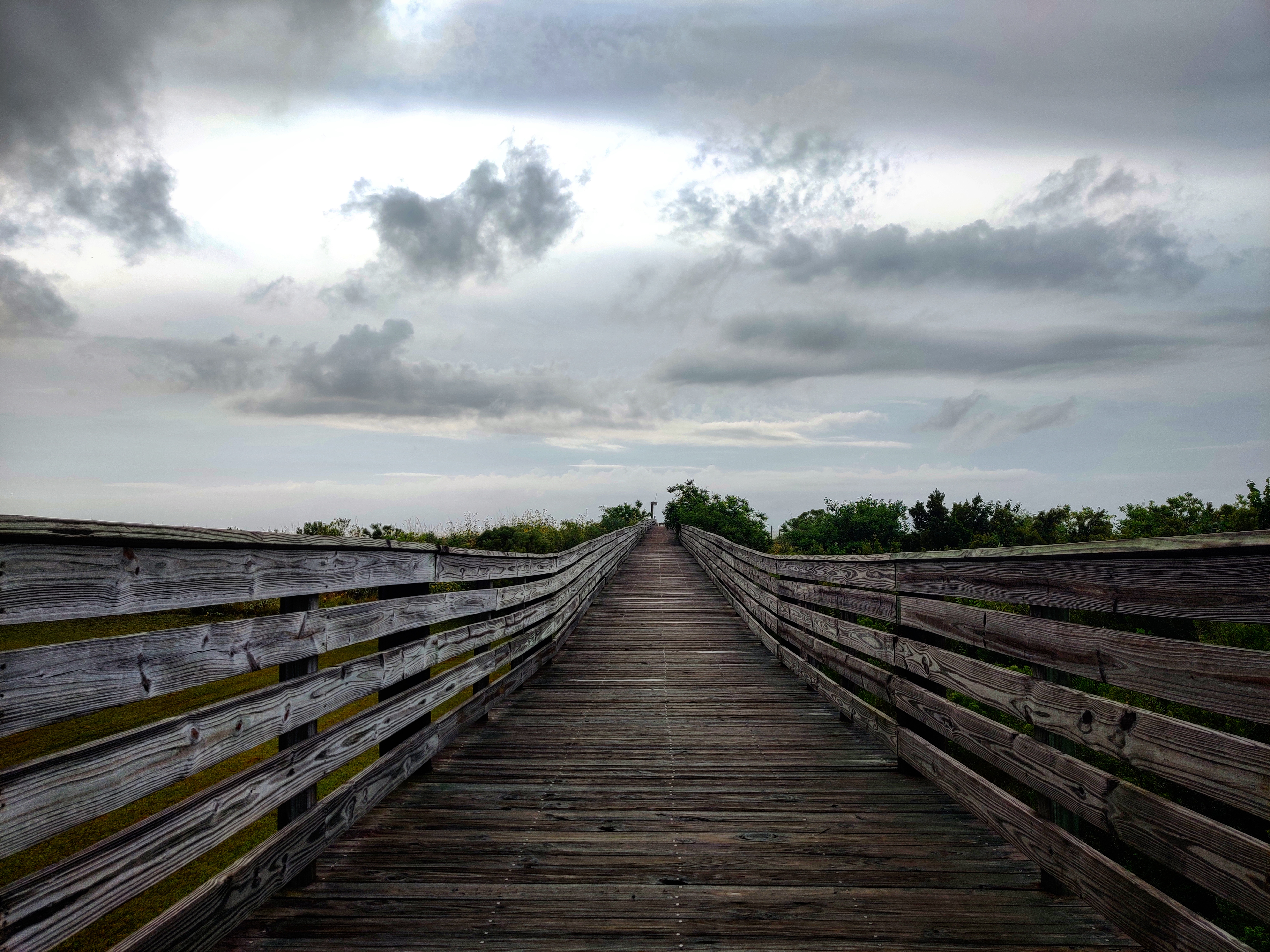
Louisiana Highway 1 runs 436 miles from Shreveport to the Gulf, and Grand Isle State Park sits at the end of it — the eastern tip of the only inhabited barrier island in the state. One mile of maintained beachfront faces open water. The observation tower looks across to Fort Livingston on Grand Terre Island. A 2.5-mile nature trail winds through coastal habitat where chenier ridges — old Mississippi sediment deposits — support live oak and hackberry. This is Louisiana's only state-owned and operated beach on the Gulf Coast, and one of the only places in the state where people surf. Forty-nine premium campsites offer water and electrical hookup. Ten beach tent sites are available for primitive camping. Canoe, paddle boat, and surf bike rentals handle the logistics. Spring migration is the reason to plan around the calendar. Hundreds of neotropical bird species pause here after crossing the Gulf of Mexico, using the island's chenier forests as stopover before continuing north. The annual Migratory Bird Festival coincides with their arrival in April. Grand Isle has been pummeled by hurricanes on average every 7.88 years since 1877 — sixteen-foot storm surges in 1893 and 1909, total destruction in 1860, and Hurricane Ida in 2021 damaging every structure on the island. The wetlands at the mouth of Barataria Bay lose acreage yearly. In 2011, volunteers planted more than 1,600 mangroves in the park to stabilize sediment. In 2012, following Hurricane Isaac, they installed dune fences and planted 12,000 plugs of dune grass along the beach. You come here because the Gulf is still here, and so is the island.
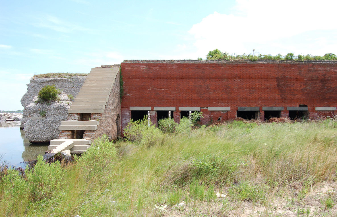 3Historic Site·1841–present (ruins)·NRHPFort Livingston
Grand Terre Island was Jean Lafitte's pirate headquarters before the federal government built a fort there in 1841. Fort Livingston stands alone as the only fort on Louisiana's Gulf of Mexico coastline and one of the largest coastal forts in the state. The government abandoned it after the Civil War. The ruins have been eroding since. You cannot walk to it. The island is off-limits. Boat tours from Grand Isle pass close enough to see what's left, and the observation tower at Grand Isle State Park gives you a sight line across the water. Fort Livingston was listed on the National Register of Historic Places on August 30, 1974. The reason to go is to see what the Gulf takes back. A federal fort built on a pirate's island, now returning to the water that made both possible.
 4Religious Site·1800s–presentGrand Isle Cemetery
The surnames carved into the tombs match the names painted on shrimp boats working the gulf today. Grand Isle Cemetery sits on Louisiana's only inhabited barrier island, on land barely above sea level, where above-ground vaults hold the dead of Cajun, Croatian, and Filipino fishing families who've worked these waters for over two centuries. Grand Isle has been hit by tropical storms or hurricanes every 2.68 years since 1877. In 1893, a 16-foot storm surge devastated the island. Another 16-foot surge hit in 1909. Hurricane Betsy in 1965 and Tropical Storm Frances in 1998 put the entire island underwater. When Hurricane Katrina pounded Grand Isle for two days in August 2005, it destroyed or damaged homes and camps along the entire island; Hurricane Rita followed less than a month later. In 2021, Hurricane Ida's eastern eyewall hit on the sixteenth anniversary of Katrina—100 percent of the island's structures were damaged, and 40 to 50 percent were completely destroyed. The cemetery floods during major storm surges. It is one of the most exposed cemeteries in Louisiana, a quiet stop on the island's main road. The island itself sits at the mouth of Barataria Bay where it meets the Gulf of Mexico—a barrier island that buffers inland parishes from the full force of hurricanes. The only land access is a causeway at the west end; the seat of parish government lies 95 miles away. Grand Isle's chenier forests contain live oaks over 125 years old, and the Govan family held their tract of land since the late 1800s. The graves here reflect that same continuity—over two centuries of island habitation, marked by the names of fishing families whose descendants still work the water.