This is the country where Louisiana runs out of land.
Before the bayous had French names, the Chitimacha and the Biloxi-Chitimacha-Choctaw ancestors of today's United Houma Nation lived on every ridge of high ground from the Atchafalaya east to the Mississippi. They traveled by pirogue on the bayous because there were no roads and the land between the bayous was marsh. Bayou Lafourche — "the fork," because it branches off the Mississippi at Donaldsonville — was the main artery. Bayou Terrebonne ran parallel a few miles west. Between them and the Gulf was a network of smaller bayous, ridges, and oak chenieres that formed the only habitable ground.
The French began settling the upper bayous in the mid-1700s. The Acadians who arrived starting in 1765 followed the waterways south, pushed toward the coast as better land was taken above. By the late 1700s, Acadian, Spanish, French Creole, African, and Houma families had intermarried and built a bayou culture that blended all of them. The long-lot farms that the French laid out along the bayous — narrow river frontage, deep back fields — are still visible in the cadastral map today. Bayou Lafourche was so thoroughly settled with houses strung along both banks that nineteenth-century writers called it "the Longest Street in the World": 106 miles of continuous habitation along one waterway.
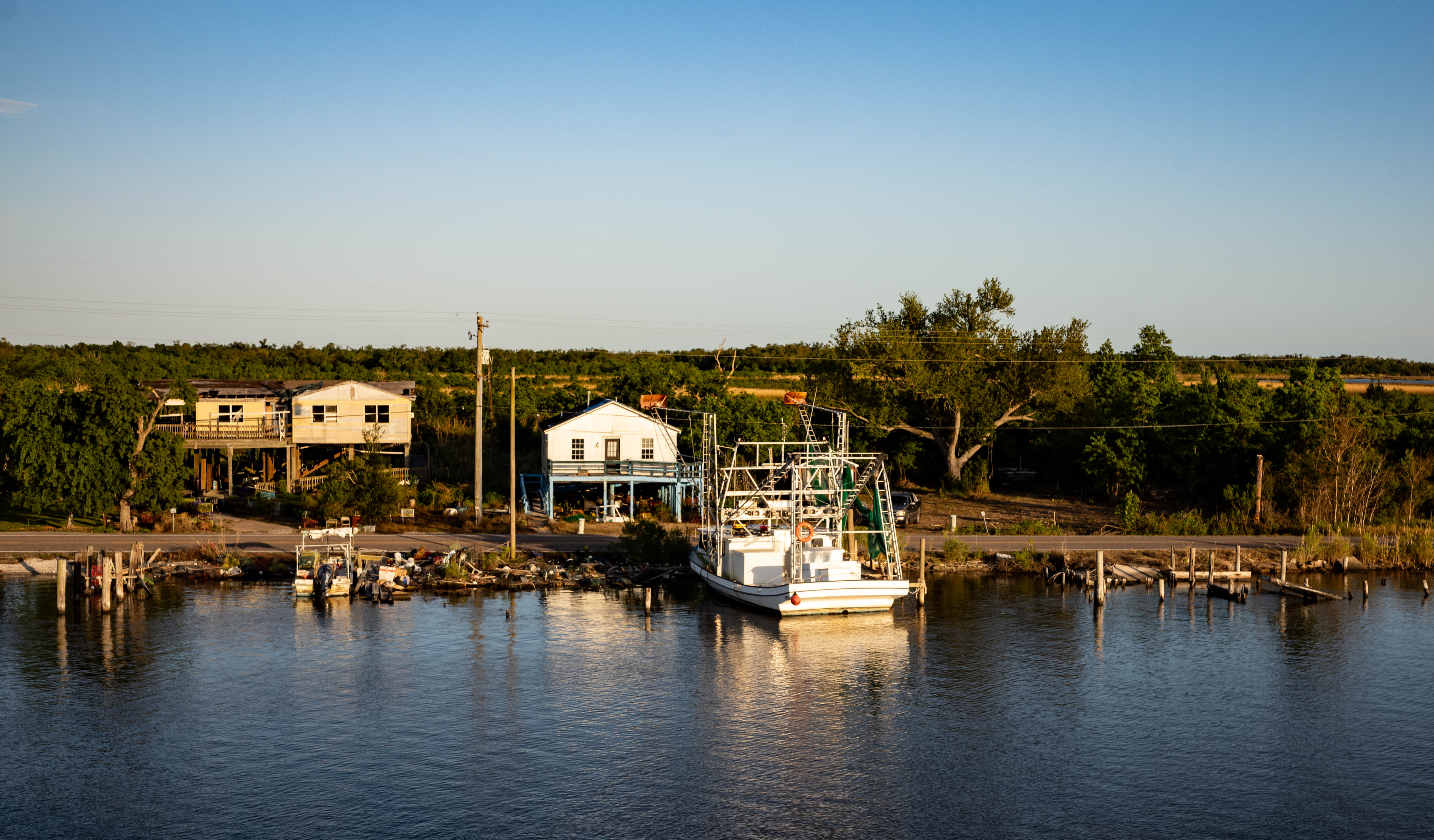
Sugar made the upper parishes. Shrimping and trapping made the lower ones. The Houma people were pushed south by Anglo and Creole land claims through the nineteenth century until they occupied the lowest country, the salt marsh at the ends of the bayous, where no one else wanted to live. There they stayed. Today the United Houma Nation numbers roughly 17,000 members, the largest Native tribe in Louisiana, concentrated in the six coastal parishes of which Terrebonne and Lafourche are the heart. They have been petitioning for federal recognition for half a century.
The twentieth century was oil. Shrimping never stopped, but oil made Houma a city and Port Fourchon — at the tip of Lafourche, where the bayou meets the Gulf — a global infrastructure hub. Something like ninety percent of deepwater Gulf oil production moves through Port Fourchon. The single road that serves it, Louisiana Highway 1, runs eighty miles down the bayou and is the only land link between the Gulf rigs and the continent. When a hurricane closes LA-1, the country's energy supply feels it within days.
And the country is vanishing. Terrebonne and Lafourche parishes lose coastal land faster than anywhere else on earth. Sea-level rise, subsidence, saltwater intrusion killing the oaks, and the levees of the Mississippi starving the delta of new sediment have combined to erase roughly a football field of marsh every hour in some decades. Whole communities — Isle de Jean Charles, Pointe-aux-Chênes, Dulac — are watching the water take the ground they have fished and trapped from for two centuries. The Houma are on the front line of American climate displacement.
What survives down here is one of the most intact bayou cultures left in Louisiana: the French of the old people, the Houma language being revived by young tribal members, the shrimp-boat blessings in March, the bayou-side camps where entire families can still gather on a Saturday afternoon to boil crabs. It is a culture built on water, and the water is winning. Portage goes there because it is still there, and because that cannot be assumed for much longer.