The Great Mississippi Flood of 1927 was the most destructive river flood in American history — and the decisions made in response to it shaped Louisiana's racial and political geography for a generation.
As floodwaters threatened New Orleans in the spring of 1927, city leaders and business interests made a calculated decision: dynamite the levee at Caernarvon, 13 miles below the city, at the site of the Robinson Canning Company — a seafood canning operation owned by William Amos Robinson. The explosion sent a wall of water across St. Bernard and Plaquemines parishes, destroying the homes, farms, and fishing grounds of thousands of Cajun and Creole families who had been promised compensation they would largely never receive. Robinson relocated his operation to Westwego, across the river, where the company continued operating into the 1980s.
New Orleans was spared. The river crested before the dynamiting would have made much difference anyway — the sacrifice may have been unnecessary. The people of St. Bernard and Plaquemines lost everything and received little in return.
The flood and its aftermath drove a massive Black migration out of the Delta and into Chicago, Detroit, and other Northern cities — one of the great accelerants of the Great Migration. It also produced the Federal Flood Control Act of 1928, which gave the Army Corps of Engineers authority and funding to build the modern levee system that protects the river cities today.
The 1927 flood is the moment Louisiana learned what the river could do — and what the powerful would do to the powerless when it came. The Robinson Canning site at Caernarvon is where that lesson was written.
What stood here
3 surviving images.
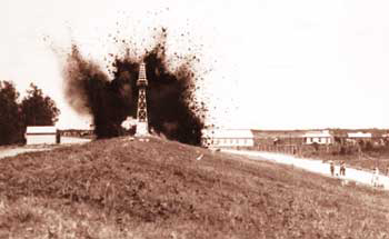
The Caernarvon levee dynamited, April 29 1927 — the wall of water released across St. Bernard and Plaquemines to spare New Orleans
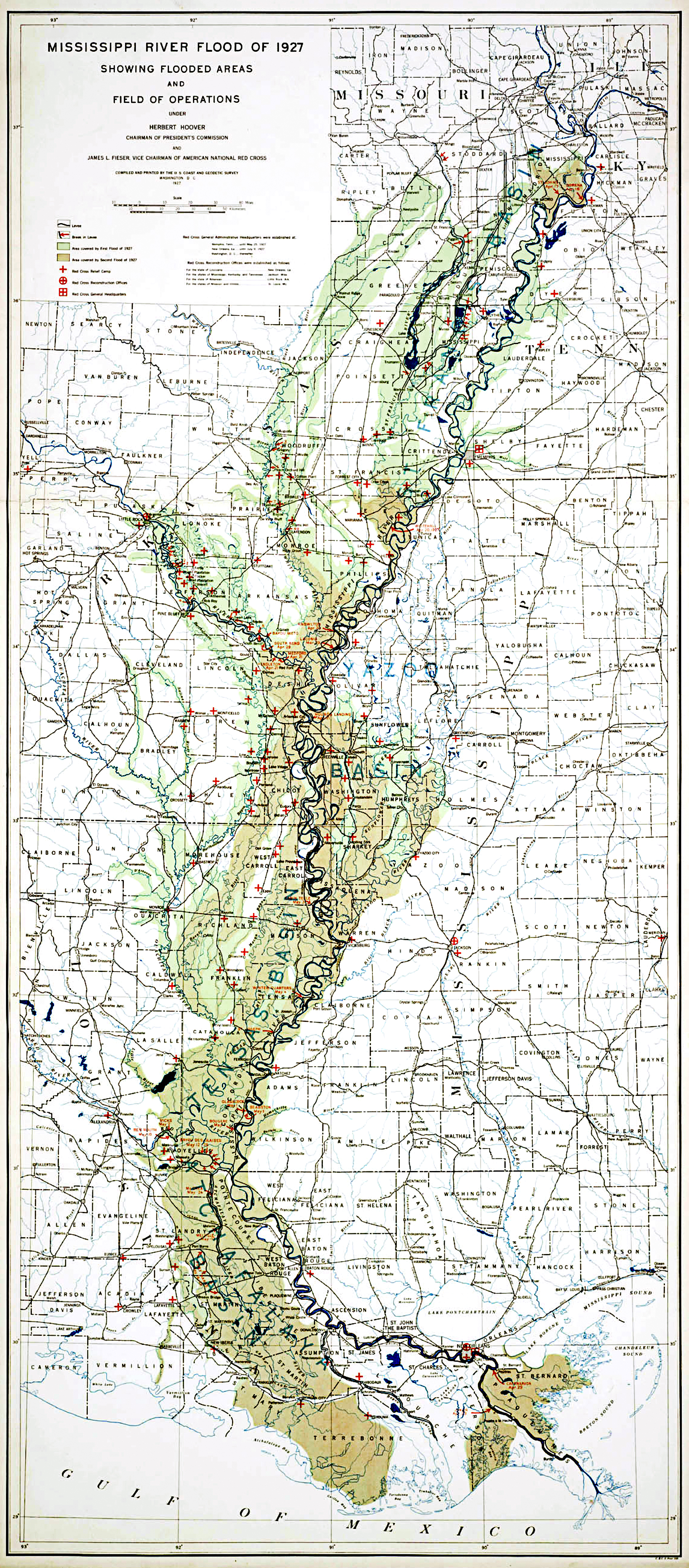
Map of the 1927 Louisiana flood extent — the river broke and the state turned brown
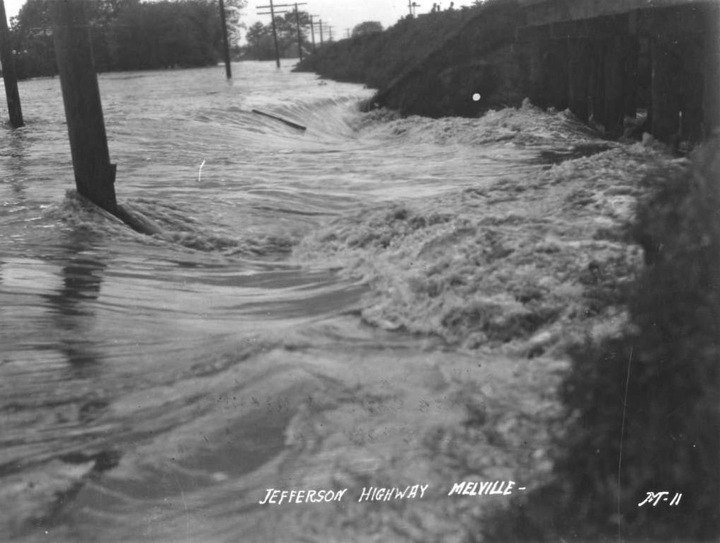
Jefferson Highway at Melville, Louisiana, in the 1927 flood — what the levee break looked like inland