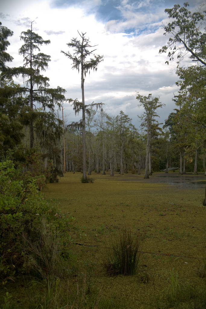
The Choctaw called it Ouiska Chitto—Big Cane Creek—for the canebrakes lining the banks, and the name stuck even after French and Anglo settlers couldn't quite pronounce it. By the 1830s, a Choctaw village sat south of Sugartown along a tributary, and the displaced people who'd left Mississippi found the 86.4-mile spring-fed creek familiar: cold, fast-running, wilderness enough to feel like home. The creek begins at present-day Fort Polk in Vernon Parish and threads through mixed pine-hardwood forest down to the Calcasieu River, passing near Sugartown, Grant, and Mittie. The water runs clear by Louisiana standards, sandy-bottomed, holding largemouth bass, spotted bass, bream, catfish, and turtles. Between the 1870s and World War I, timber companies floated logs down Whiskey Chitto to the mills in Lake Charles. Near Mittie, a federal agent found evidence of illegal cutting on federal lands—evidence that ignited the Calcasieu Log War of 1877-1879 and shut down logging operations until the issue was resolved. The creek carried the region's economic bloodstream for decades. Two historic bridge crossings still mark the Mittie section: the La 26 bridge, a concrete span built in the early 1970s to replace a 1929 wooden bridge destroyed by fire—purposely built 777 feet long, the "Lucky Bridge"—and Carpenter's Bridge downstream, named for the family that settled the area in the early 1870s and replaced in 2024 after more than a century of wooden spans. In 1970, Louisiana designated Whiskey Chitto a scenic waterway under the Scenic Rivers Act, administered by Louisiana Wildlife and Fisheries. The U.S. Army Corps of Engineers declared it a navigable stream of the United States in 2008. The northern section passes through Kisatchie National Forest, overseen by the Vernon Unit of the Calcasieu Ranger District. Local outfitters run shuttle service for canoeists and kayakers; the section near Mittie is known for paddling and fishing, best in spring and summer when water levels hold. The creek threads through some of the oldest continuously settled ground in southwest Louisiana—Sugartown since the 1820s, the lower stretch from Mittie to Leblanc since the 1850s and 1860s. The sandy soil along the banks grows Sugartown Watermelons. Ernest S. Clements, who served as a Louisiana state senator, Secretary of Wildlife and Fisheries, and Public Service Commissioner, kept a camp near Mittie and spent his time on the water. Descendants of early settlers still call themselves River People, a term the Choctaw used, and some carry family stories of Choctaw ancestry. The United Methodist Church operates the UskiChitto Retreat Center along the creek north of Leblanc, 120 acres where you can still imagine log rafts moving downstream in the quiet.
- ·Sandy-bottomed creek east of DeRidder — one of the best paddling runs in SWLA.
- ·Clear water by Louisiana standards. Popular for canoeing, kayaking, and tubing.
- ·Name derives from Choctaw: 'cane' + 'big,' for the canebrakes along the banks.
- ·Local outfitters offer canoe and kayak shuttles.
- ·Best in spring and summer when water levels are moderate.
Memories
Nearby
Editorial content compiled with AI assistance. Place details verified against public records.